


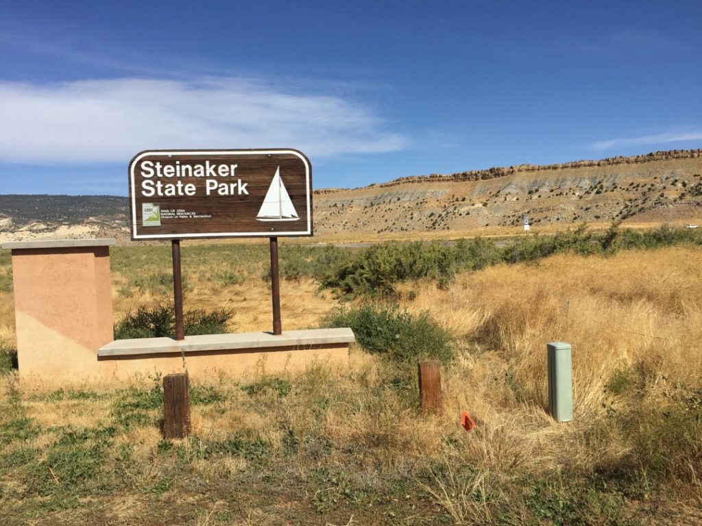
The Red Mountain trails are located in Uintah County approximately 8 miles north of Vernal at Steinaker Lake State Park and 215 miles east of Salt Lake City. The trailhead (such as it is) is located at 40.5337859,-109.5289057, just 1,800 feet west of Hwy 91 on 301 (the road to Steinaker Park). This is about the only free parking in the area. You can, of course, pay the fee and use Steinaker State Parks facilities or even camp there.
While we rode approximately 32 miles, there are many many more miles of trail in the area. It will take you 3-4 hours to explore this system depending on your driving and whether you take some of the side trails available. There are no services (unless you enter Steinaker State Park) so stock up on anything you need before leaving Vernal.
- Directions From the North
- Directions from the South
- Facilities: Steinaker State Park
- You may encounter gates. Leave them as you find them.
- All OHVs: 50″ ATVs, UTVs & MCs and full-sized 4x4s
- Signing: Most Trails have adequate signage
- GPX File for your Garmin GPS or other Apps
We highly recommend you get GAIA GPS for your smartphone or tablet mobile device. GAIA GPS will allow you to download this trail complete with the photos you see here so you can be sure where you are at all times. Simply install the GAIA GPS app and save this trail from here: DOWNLOAD THIS TRAIL
Here is an embedded live link to GAIA GPS to allow you to explore the trail. Each of the blue markers indicates that a photo was taken at that location. To view the track and photos click here: GAIA GPS – Red Mountain
Would you like to see the Red Mountain Trail in an animated 3D flyover map? If it appears to pause that is likely a place I stopped for a while. It will continue, just wait a few moments. 3D Flyover Link.
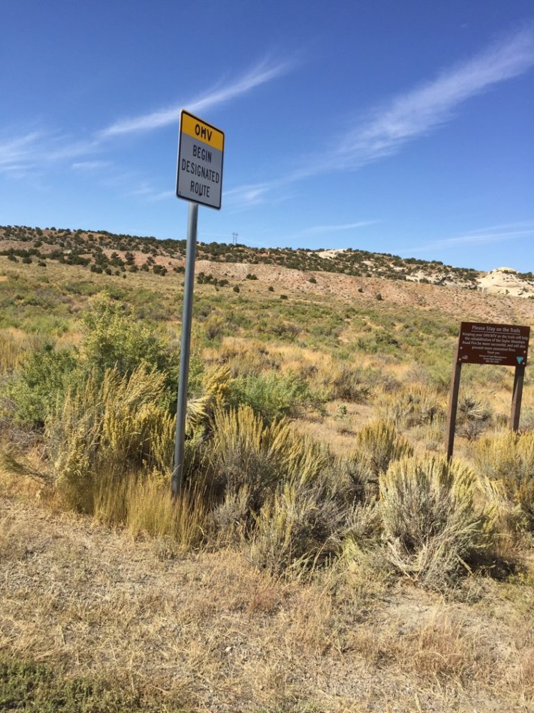
Here is the parking area where we unloaded. There is no fee. It has plenty room for big rigs to turn around. There are no facilities. NOTE: You need to be street legal to use the road from here to the actual trailhead. If you pay the fee and enter Steinaker State Park, the section of pavement from the park entrance to the trailhead is designated as an OHV route for non-street legal access to the trails.
The trailhead is an unmarked road leaving the pavement. There is no parking here and no facilities. Note that the designate OHV route begins here and goes to Steinaker State Park.
Feel free to tour around a bit inside Google Street Views. We have recorded the trail in 360, and it is now part of Google Street Views so you can take a virtual tour of the trail to see if it is for you. While we didn’t have time to ride all of the trails we think you will find this fairly representative of what you will find. We’ve made it a bit easier to navigate, scroll down and you will see more 360 embedded tours as we encounter intersections, trail markers or interesting places along the trail.
On any image, you can click the ‘X’ in the upper right corner and the view will change to an overview map showing the Google Street View blue lines. You can click anywhere on that blue line and drop down to the 360 ground-level views at that point.
You can move the image 360 degrees, click the arrow to move further down the trail, and zoom in and out to take a closer look. Clicking the box in the upper right-hand corner will enlarge to full screen for a better view.
Five minutes into our ride and we already missed a turn and hit our first dead-end. No worries, it is all part of the fun.
While much of the trail is sand, there are occasional ledges, nothing particularly difficult until we start climbing Red Mountain.
We opted to head towards the hills as quickly as we could. We think you will agree it was a good choice.
When cool rock formations beckon, we answer the call.
The trail drops into the bottom of the canyon and slowly narrows until we gave up trying to do trail maintenance and record 360 tours. In a 50″ UTV or ATV, you might be able to continue, but we gave up in the ranger and backtracked. As you may note in the GPS track we will eventually come within a few hundred yards of this position later in the day. Does anyone want to organize a tree-trimming party?
Looping around to head up Red Mountain is a fun track of sand.
The view as we climb Red Mountain is really nice.
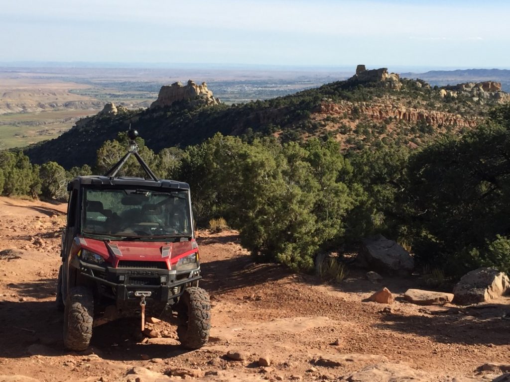
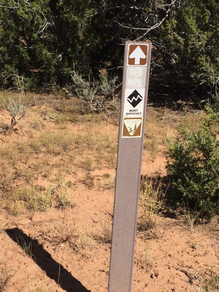
The road gets progressively rougher and more difficult as we progress up Red Mountain and is marked most difficult.
We know it is tempting to ‘hi-point’ or take the wider trail routes. Please don’t. This is the kind of trail widening that bothers some people and could lead to trail closures as it is used as evidence of abuse.
There are a few tangents turns like this one. We figured out they end pretty quickly. Stay to the left.
If your beginner and intermediate riders haven’t turned back yet they might consider it now. We didn’t make it much further ourselves.
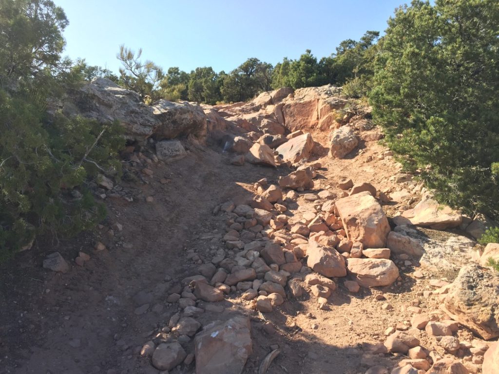
At this point, the trail turns into a large boulder and ledges field — just the kind of thing expert riders seek out. While the Ranger could have made it further, we had no other ride home or way to get immediate help. Maybe if we had a few more rigs on this trip we would have been tempted. But, it seemed prudent to call it a day. Next time Red Mountain, next time.
With that, we turned around and called it a day. A great one.
Here is a photo gallery of all of the Images we took along the way. Not necessarily in any order or sequence. Many are at trail intersections. You can see the photos and exactly where along the trail where taken: Click here for Photo Locations.


Emergencies
The closest medical help is Ashley Regional Medical Cente 150 W 100 N, Vernal, UT 84078 Dial 911 for Emergencies or (435) 789-3342
Uintah County Sheriff’s Office 641 E 300 S, Vernal, UT 84078 Dial 911 for Emergencies or (435) 789-2511
Utah Highway Patrol Dial 911 641 East, 300 South, Suite 300
Vernal, Utah 84078 (435) 781-6740
Ashley National Forest 355 North Vernal Avenue Vernal, UT 8407 435-789-1181

