

You can find ample parking in town. The city park makes for a nice spot to start from since its a central location and close to the road that will take you to the dirt.
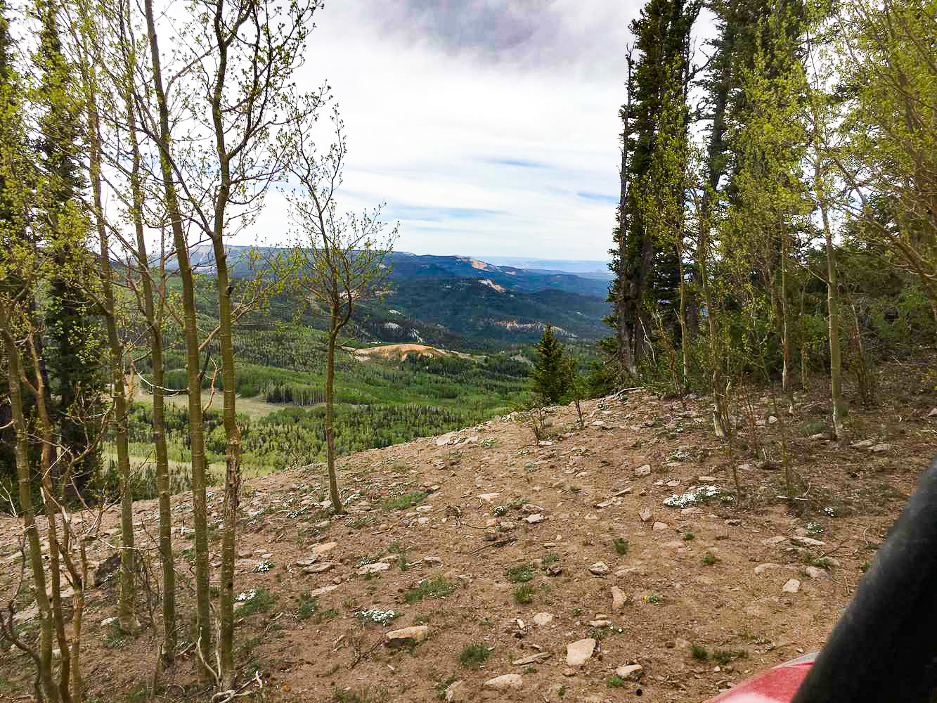
Once you get on to Posey Lake Road, just take it north until the pavement ends and the dirt road begins.
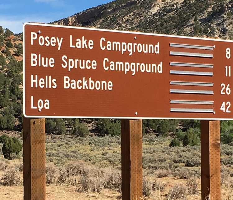
First sign a few miles into the trail giving you distnaces to campgrounds and other locations. You can even take these roads all the way out to Loa!
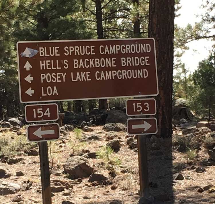
 To stay on the loop take the left fork at this sign onto route 154. The sign sits between 15 miles into the trail.
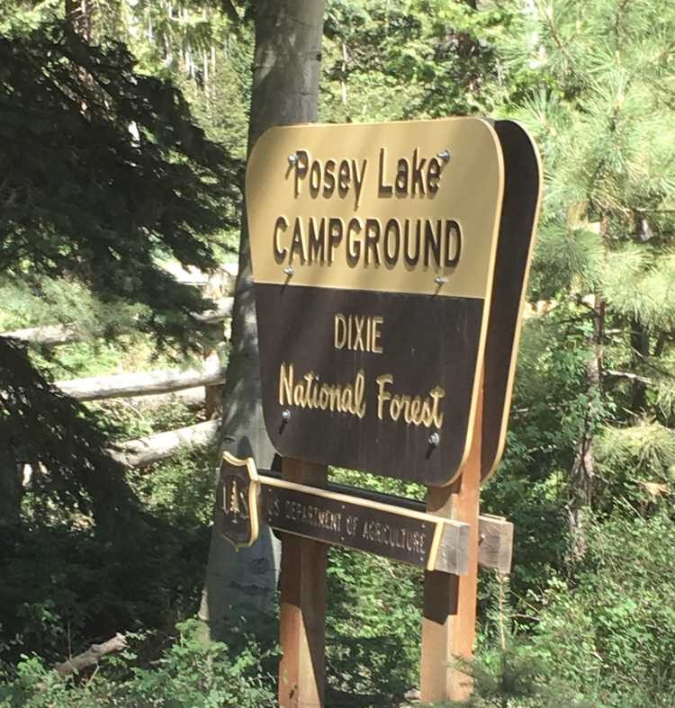
 Posey Lake and Campground are about 20 miles into the trail. Beautiful spot to camp, or enjoy the scenery. Restrooms are available at the campground.
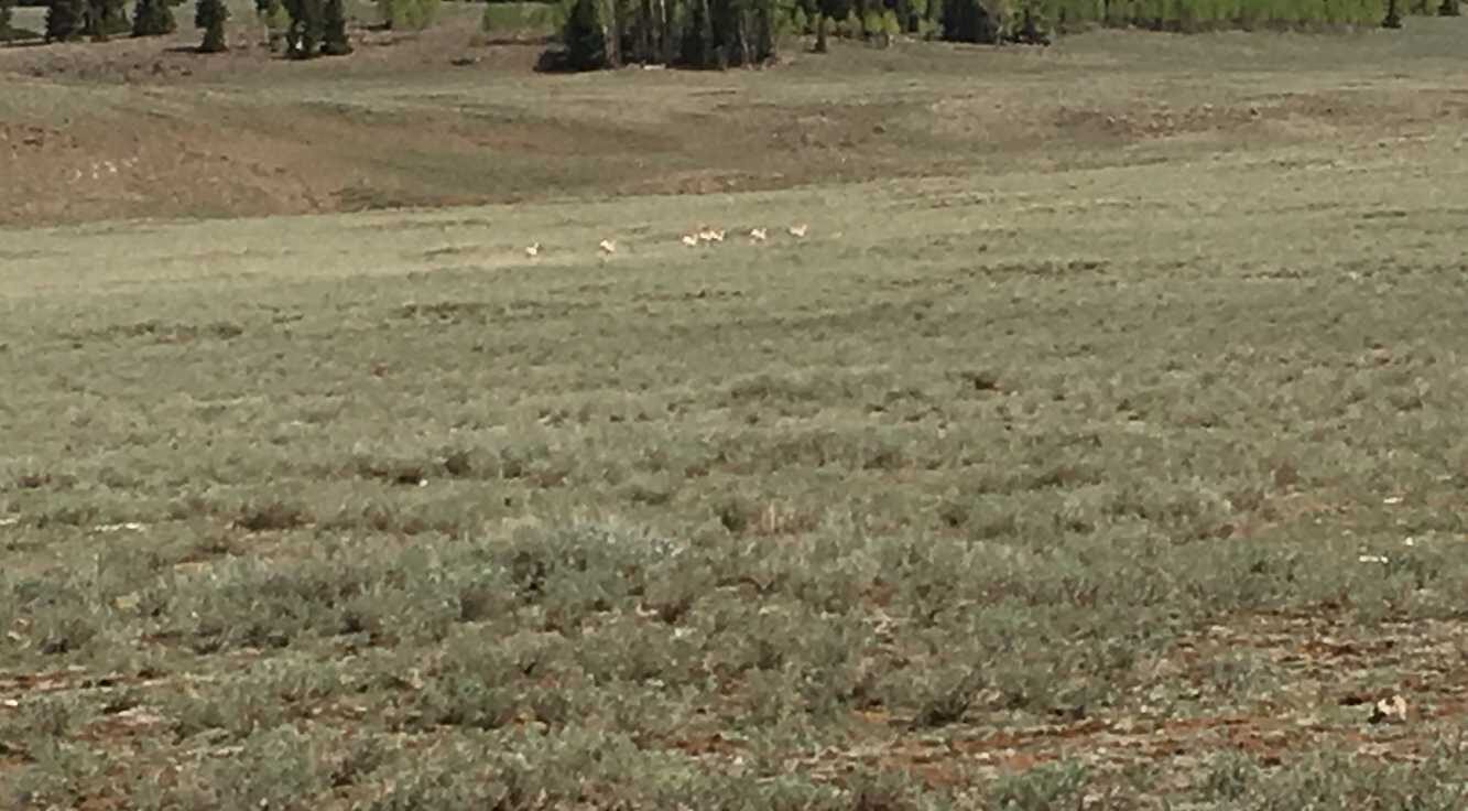
 Plenty of chances to spot some wildlife! Here's a herd of deer we caught while driving along Route 140.
 Offshoot to Clayton Trail which can take you down into Antimony. Go straight to keep heading toward Griffin Top.
More signage for another offshoot trail. Once again, remain straight on the road to reach Griffin Top.
Turn east on this offshoot road, Route 1377, to Griffin Top. The view area is out and back, so you'll do a little backtracking to get back on to Route 140 after enjoying the view.
The gorgeous viewpoint once you reach Griffin Top! After enjoying the view you can drive back to Route 140 the same way you came in.
To complete the loop, get back onto Route 140 and turn right to head south.
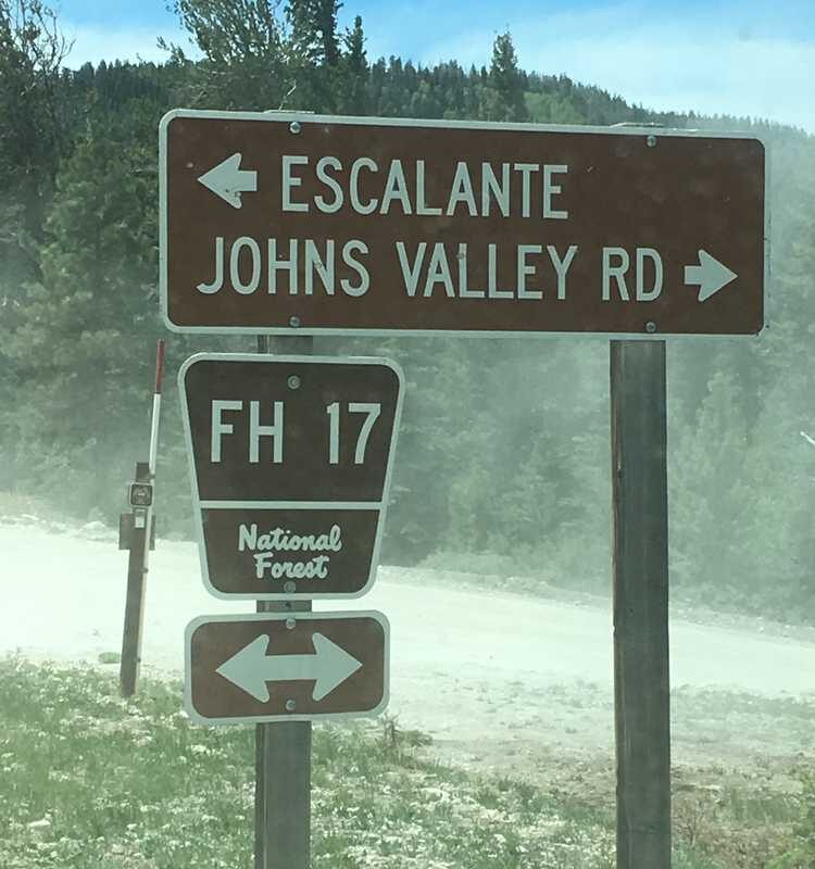
The final route you will turn onto is Route 17. At this intersection there is some complicated braiding, so make sure you spot and follow the right sign. You will be following Route 17 east. After following the trail it will end on Scenic Byway 12, which you can turn east onto to get back to Escalante.
Offshoot to Clayton Trail which can take you down into Antimony. Go straight to keep heading toward Griffin Top.
More signage for another offshoot trail. Once again, remain straight on the road to reach Griffin Top.
Turn east on this offshoot road, Route 1377, to Griffin Top. The view area is out and back, so you'll do a little backtracking to get back on to Route 140 after enjoying the view.
The gorgeous viewpoint once you reach Griffin Top! After enjoying the view you can drive back to Route 140 the same way you came in.
To complete the loop, get back onto Route 140 and turn right to head south.
The final route you will turn onto is Route 17. At this intersection there is some complicated braiding, so make sure you spot and follow the right sign. You will be following Route 17 east. After following the trail it will end on Scenic Byway 12, which you can turn east onto to get back to Escalante.
To stay on the loop take the left fork at this sign onto route 154. The sign sits between 15 miles into the trail.
Posey Lake and Campground are about 20 miles into the trail. Beautiful spot to camp, or enjoy the scenery. Restrooms are available at the campground.
Plenty of chances to spot some wildlife! Here's a herd of deer we caught while driving along Route 140.
Offshoot to Clayton Trail which can take you down into Antimony. Go straight to keep heading toward Griffin Top.
More signage for another offshoot trail. Once again, remain straight on the road to reach Griffin Top.
Turn east on this offshoot road, Route 1377, to Griffin Top. The view area is out and back, so you'll do a little backtracking to get back on to Route 140 after enjoying the view.
The gorgeous viewpoint once you reach Griffin Top! After enjoying the view you can drive back to Route 140 the same way you came in.
To complete the loop, get back onto Route 140 and turn right to head south.
The final route you will turn onto is Route 17. At this intersection there is some complicated braiding, so make sure you spot and follow the right sign. You will be following Route 17 east. After following the trail it will end on Scenic Byway 12, which you can turn east onto to get back to Escalante.
Enter your name and email and get notified when we add new trails... it's FREE!

Our goal is 150 Trails in Utah, don't miss out as we continue to provide you great riding areas.
Your information will *never* be shared or sold to a 3rd party.
