

The Barracks Trail in Kane County is a great trail to explore and familiarize yourself with the Mount Carmel Junction Area trails. This trail takes you about 27 miles through the gorgeous landscape of Southern Utah. We started off just South of the town of Mount Carmel Junction and ended the ride right next to Coral Pink Sand Dunes State Park. While this ride will only take you about 3.5 hours (moving time), there are camping sites along the trail if you wanted to spend more time riding trails in the area. There is a lot of beauty in this area.
You can expect to be driving on mostly dirt roads. Depending on the time of year you ride this trail, you may run into some water and snow.
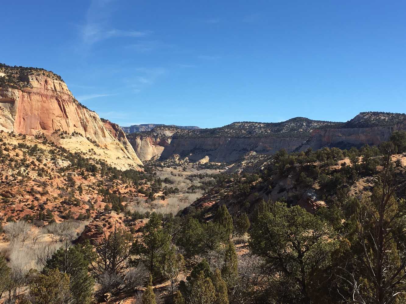
This trail provides great opportunities to stop, get out, and take in the views.
You can also find just about every amenity you need including gas, lodging, and food in the town of Mount Carmel Junction or Kanab.
GAIA
We highly recommend you get GAIA GPS for your mobile device. GAIA GPS will allow you to download this trail complete with the photos you see here so you can be sure where you are at all times. Simply install the GAIA GPS app and save this trail from the button below.
- Directions From the North
- Directions from the South
- Facilities: Lodging, restaurants, fuel and groceries are available in the town of Mount Carmel Junction or Kanab.
- OHVs: Mostly OHV trail-style riding.
- Terrain: Mostly dirt and sand trails - some rocky areas. Mostly OHV trail-style riding.
- Signage: signs at most intersections noting distance to landmarks and direction of travel.
- KML File for Google Maps
- GPX File for your Garmin GPS or other Apps
- Emergencies: Kane County Hospital: 355 N. Main, Kanab, UT 84741
- Kanab Police Department: Dial 9-1-1 for emergencies or Non-Emergency Dispatch: 435-644-5854. We highly recommend you purchase a Utah Search and Rescue Assistant Card (USARA) learn more: https://secure.utah.gov/rescue/
Here is the 360 view at the trailhead. Feel free to tour around a bit inside Google Street Views. We have recorded the trail in 360 and it is now part of Google Street Views so you can take a virtual tour of the trail to see if it is for you. We’ve made it a bit easier to navigate, scroll down and you will see more 360 embedded tours as we encounter intersections, trail markers or interesting places along the trail.
On any image, you can click the ‘X’ in the upper right corner and the view will change to an overview map showing the Google Street View blue lines. You can click anywhere on that blue line and drop down to the 360 ground-level views at that point.
You can move the image 360 degrees, click the arrow to move further down the trail and zoom in and out to take a closer look. Clicking the box in the upper right-hand corner will enlarge to full screen for a better view.
You can view this Mt. Carmel Junction OHV trails maps and other trail information on this PDF found of Utah State Parks website. https://stateparks.utah.gov/stateparks/wp-content/uploads/sites/26/2015/02/Mt_Carmel_Junction_OHV.pdf

