

The Jacobs Chair Trail is 32 miles of back country roads among the scenic bluffs and buttes of southeastern Utah. We spent 4.5 hours on the trail traveling at 7.5 mph but plan a full day on the trail because the trailhead is 70 miles from the nearest town. This trail is best suited for experienced riders with some rocky and skinny segments of the trail.
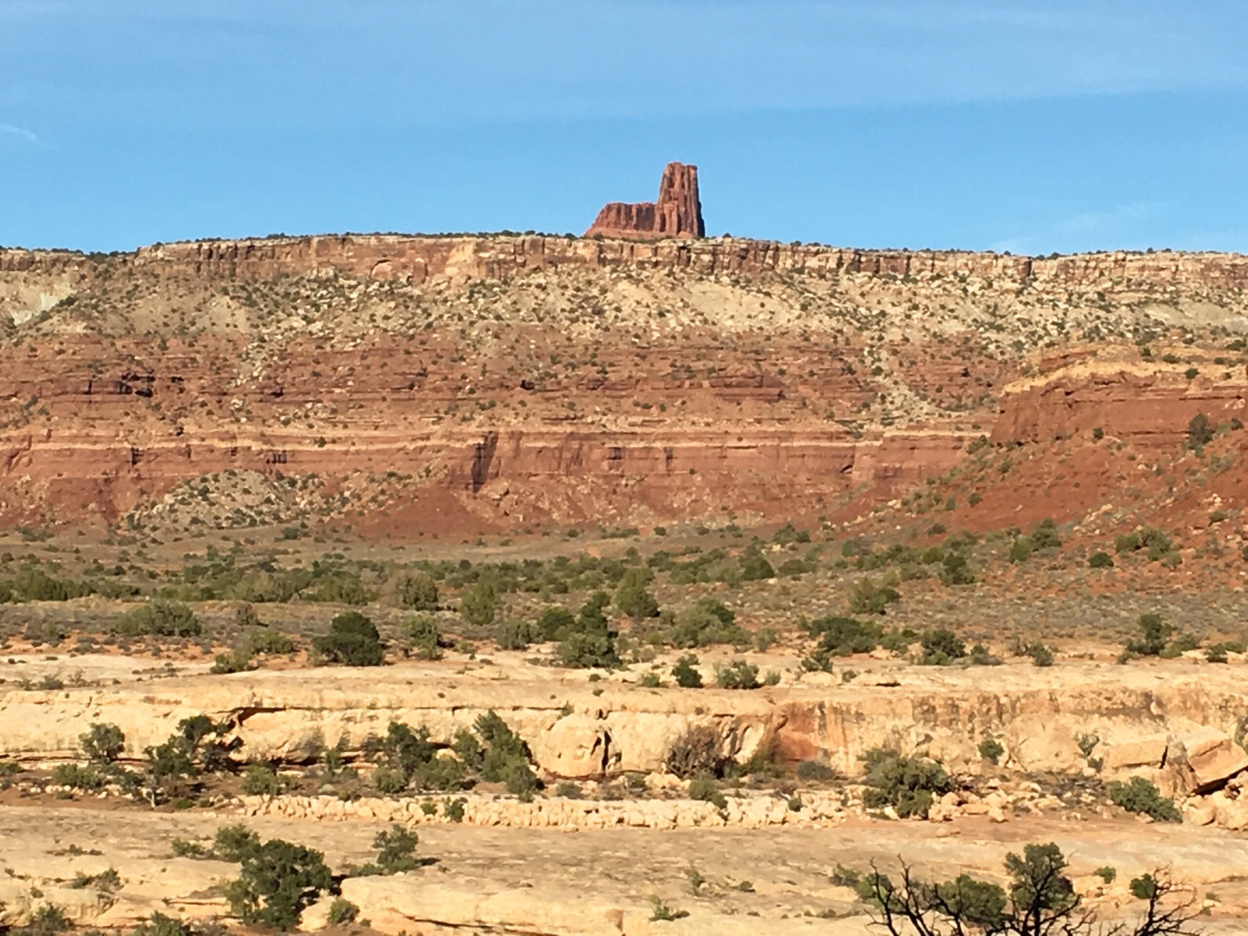
Jacobs Chair is named for the “chair-like” formation that this trail loops around.
There are some remnants of an old homestead to view. Remember to leave any artifacts you come across (this includes anything older than 50 years in the area).
The trailhead is 62 miles southeast of Hanksville, 70 miles northwest of Mexican Hat and 65 miles west of Blanding. There is a parking area right off State Route 95. The trail is in a remote area of the state so let someone know where you are going and when you plan on returning. You will want to fill up your tanks and stock up on water and supplies before heading out. Get a feel for the trail and plan your trip with the information below.
- Directions From the North
- Directions from the South
- Facilities: No Services for 70 miles in any direction. Stock up on water, supplies and gas in Hanksville, Mexican Hat or Blanding.
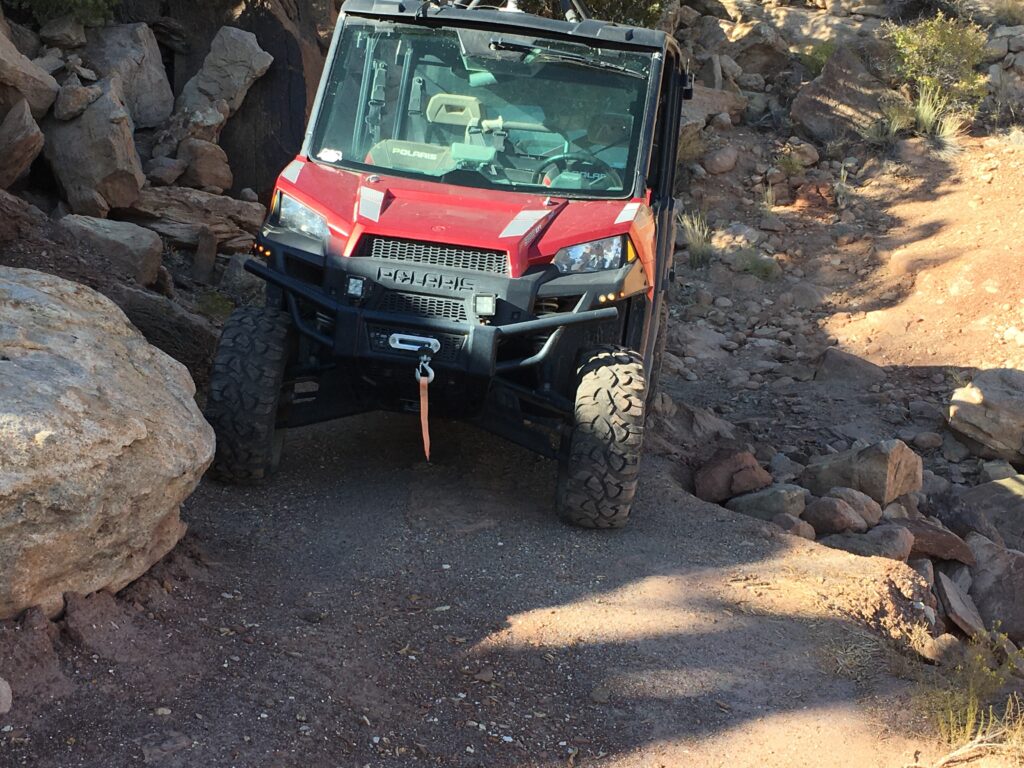
- OHVs: ATVs, MCs, UTVs, 4x4s on most trails. *there were a couple spots on the trail that are a tight squeeze in a 4×4 (take a look at the 360 view below to look at those segments).
- Terrain: Back country roads with some skinny segments of trail with a few technical obstacles. This trail is best for experienced riders.
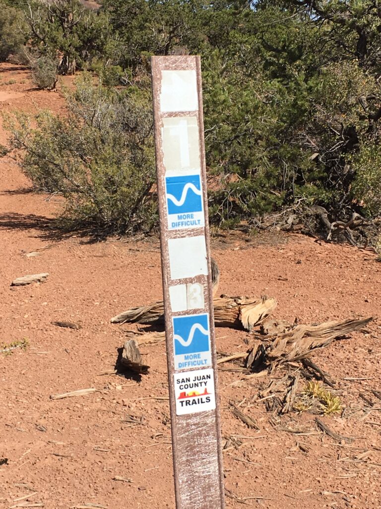
- Signage: The trail is well marked. Stay on designated trails. Some of the numbers may be faded but are still legible.
- KML File for Google Maps
- GPX File for your Garmin GPS or other Apps
- Download Printable Map (Large File)
We highly recommend you get GAIA GPS for your smartphone or tablet mobile device. GAIA GPS will allow you to download this trail complete with the photos you see here so you can be sure where you are at all times. Simply install the GAIA GPS app and save this trail from here: DOWNLOAD THIS TRAIL
Here is an embedded live link to GAIA GPS to allow you to explore the trail. Each of the blue markers indicates that a photo was taken at that location. To view the track and photos click here: GAIA GPS – Jacobs Chair Trail – San Juan CO Utah
Would you like to see the Jacobs Chair Trail as an animated 3D flyover map? If it appears to pause that is likely a place we stopped for a while. It will continue, just wait a few moments. Link to 3D flyover.
Here is the 360 view at the trailhead. Feel free to tour around a bit inside Google Street Views. We have recorded the trail in 360, and it is now part of Google Street Views so you can take a virtual tour of the trail to see if it is for you. While we didn’t have time to ride all of the trail we think you will find this fairly representative of what you will find. We’ve made it a bit easier to navigate, scroll down and you will see more 360 embedded tours as we encounter intersections, trail markers or interesting places along the trail.
On any image, you can click the ‘X’ in the upper right corner and the view will change to an overview map showing the Google Street View Blue lines. You can click anywhere on that blue line and drop down to the 360 ground-level views at that point.
You can move the image 360 degrees, click the arrow to move further down the trail and zoom in and out to take a closer look. Clicking the box in the upper right-hand corner will enlarge to full screen for a better view.
There is a parking area off the west side of the highway (SR95).
Heading north along the trail you will pass a sign reminding that this area is limited to travel on designated routes and you may encounter impassable road conditions during inclement weather.
Turn right to continue on Route 43.
One of the difficult trail segments.
Continue north following the carsonite marking Route 43.
Follow Route 43 heading northeast. The Henry Mountains are the distant range you will see along this route looking to the northwest.
This appears to be a homestead that has been lost to the desert and time.
Continue heading east on Route 43.
Turn right to continue on southward. There is a sun-worn sign that is marking this trail as a more difficult route which we experienced earlier on.
Scenic desert landscapes abound on this ride.
Continue on to the right following signs for Route 1.
This was another tricky spot on the trail where a rock is blocking some of the road.
Keep right to stay on Route 1.
Continuing on Route 1. Jacobs Chair has come into view.
Jacobs Chair from the highway (SR95). Once you hit the pavement, head north to get back to the trailhead.
Here is a photo gallery of all of the images we took along the way. Not necessarily in any order or sequence. Many are at trail intersections. You can see the photos and exactly where along the trail where taken: Click here for Photo Locations.


Emergencies
The closest medical help (over an hour from the trailhead) is the San Juan Hospital, 380 W 100 N, Monticello, UT 84535. (435) 587-2116 | Dial 9-1-1 for emergencies.
San Juan County Sheriff: Dial 9-1-1 or (435) 587-2237
Utah Highway Patrol: (435) 587-2000
Utah Highway Patrol: Dial 9-1-1
We highly recommend you purchase a Utah Search and Rescue Assistant Card (USARA), learn more: https://secure.utah.gov/rescue/

