

The Sanpitch OHV trail is located in Sanpete County, up Log Canyon just to the northwest outside of Fountain Green, Utah. The trail is approximately 25 miles long and took about 2.5 hours to run at an average speed of 7 mph. So plan about four hours for this trail to include some time for exploring and having lunch along the way.
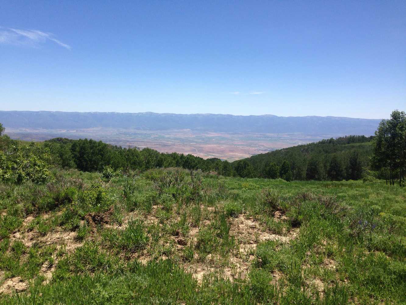
The trail is quite scenic, climbing through aspen trees up on top with no major obstacles to enjoy a pleasant day of riding.
- Directions From the North
- Directions from the South
- Facilities: You start out in the town of Fountain Green, Utah.
- You may encounter gates. Leave them as you find them.
- OHVs: All sizes. No width limits. ATVs, MCs, UTVs, 4x4s on most trails.
- Signing: Most trails have adequate signage
- KML File for Google Maps
- GPX File for your Garmin GPS or other Apps
We highly recommend you get GAIA GPS for your smartphone or tablet mobile device. GAIA GPS will allow you to download this trail complete with the photos you see here so you can be sure where you are at all times. Simply install the GAIA GPS app and save this trail from here: DOWNLOAD THIS TRAIL
Here is an embedded live link to GAIA GPS to allow you to explore the trail. Each of the blue markers indicates that a photo was taken at that location. To view the track and photos click here: GAIA GPS – Sanpitch OHV Trail.
Would you like to see the trail in an animated 3D flyover map? If it appears to pause, that is likely a place I stopped for a while. It will continue, just wait a few moments. Link to 3D flyover.
Here is the 360 view at the trailhead. Feel free to tour around a bit inside Google Street Views. We have recorded the trail in 360 and it is now part of Google Street Views so you can take a virtual tour of the trail to see if it is for you. We’ve made it a bit easier to navigate, scroll down and you will see more 360 embedded tours as we encounter intersections, trail markers or interesting places along the trail.
On any image, you can click the ‘X’ in the upper right corner and the view will change to an overview map showing the Google Street View Blue lines. You can click anywhere on that blue line and drop down to the 360 ground-level views at that point.
You can move the image 360 degrees, click the arrow to move further down the trail and zoom in and out to take a closer look. Clicking the box in the upper right-hand corner will enlarge to full screen for a better view.
Log Canyon Road off of Hwy 132. There is a place to stage from just off the highway if you prefer.
Head south at the fork in the road continuing on FR0069.
Side trail to a view and a good stop for lunch. Elevation 9,397 ft.
Trailhead for a short hike.
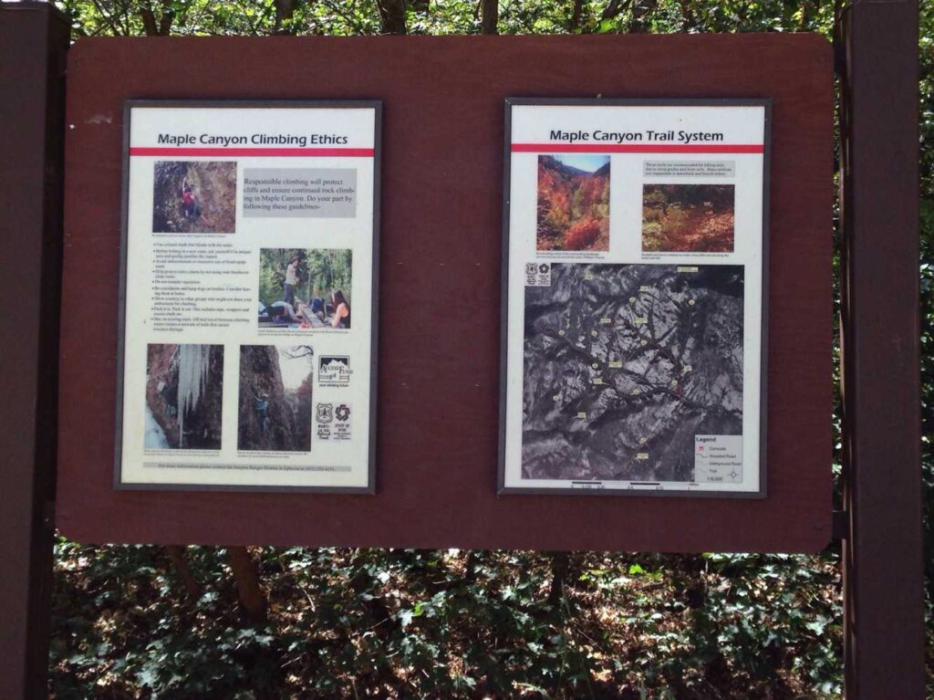
The Maple Canyon Campground is near the end of the trail. There is a restroom, camping and rock climbing access for the adventurers out there. Check the forest service’s website for more information about the area. https://www.fs.usda.gov/recarea/mantilasal/recarea/?recid=73474
You’ll be back to the blacktop at the bottom of Maple Canyon. There are places to stage here and access to camping if you choose to stay and explore the area for a few days.
Here is a photo gallery of all of the images we took along the way. Not necessarily in any order or sequence. Many are at trail intersections. You can see the photos and exactly where along the trail where taken: Click here for Photo Locations.


Emergencies
The closest medical help is the Central Valley Medical Center. 275 W 300 S Street, Fountain Green, UT 84632. Phone: 435-445-3301. Dial 9-1-1 for emergencies.
Sanpete County Sheriff: Dial 9-1-1 or 435-835-2191. 1500 S Hwy 89, Manti, UT 84642
Utah Highway Patrol: Dial 9-1-1

