

The Forshea Mountain trails part of the Paiute Trail system and are located in Piute County and starts in the town of Marysvale UT. 178 miles south of Provo Utah. The trailhead begins in Marysvale Town Park where you are welcome to park while you ride. There is a restroom with running water here. While we rode approximately 59 miles there are many many more miles (thousands) of trail in the area. It will take you 5-6 hours to explore this trail depending on your driving and whether you take some of the side trails available. There are no services out on the trail so stock up on anything you need before leaving Marysvale.
- Directions From the North
- Directions from the South
- Facilities: Restroom. You are in a town with most services.
- You may encounter Gates, Leave them as you find them.
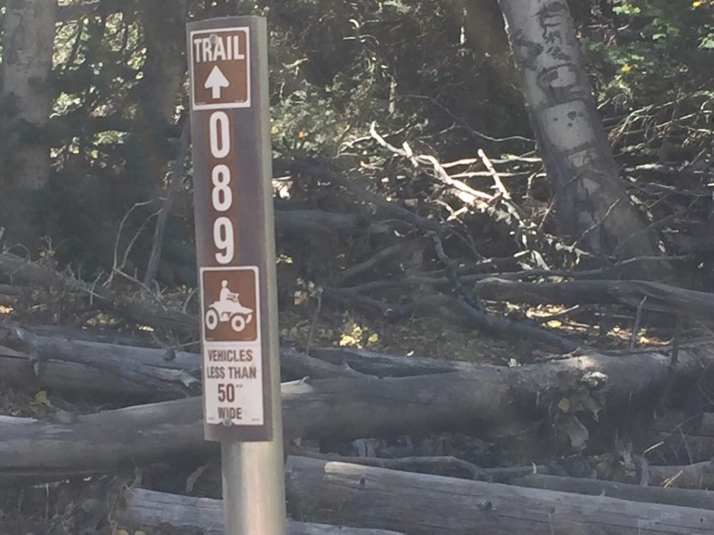
- All OHVs: 50″ ATV’s, UTV’s & MC’s and full-sized 4x4s
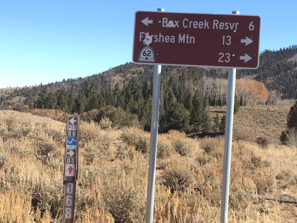
- Signing: Most Trails have adequate signage
- Online Printable Map (only cover the South end of the trail)
- GPS track in GPX File for your Garmin GPS or other Apps
- GPS track in KML file for Google Maps
We highly recommend you get GAIA GPS for your smartphone or tablet mobile device. GAIA GPS will allow you to download this trail complete with the photos you see here so you can be sure where you are at all times. Simply install the GAIA GPS app and save this trail from here: DOWNLOAD THIS TRAIL
Here is an embedded live link to GAIA GPS to allow you to explore the trail. Each of the blue markers indicates that a photo was taken at that location. To view the track and photos click here: GAIA GPS – Forshea Mountain
Would you like to see the Forshea Mountain Trail in an animated 3D flyover map? If it appears to pause that is likely a place I stopped for a while. It will continue, just wait a few moments. 3D Flyover Link.
Feel Free to tour around a bit inside Google Stree Views. We have recorded the trail in 360 and it is now part of Google Street Views so you can take a virtual tour of the trail to see if it is for you. While we didn’t have time to ride all of the trails we think you will find this fairly representative of what you will find. We’ve made it a bit easier to navigate, scroll down and you will see more 360 embedded tours as we encounter intersections, trail markers or interesting places along the trail.
On any image, you can click the ‘X’ in the upper right corner and the view will change to an overview map showing the Google Street View Blue lines. You can click anywhere on that blue line and drop down to the 360 ground-level views at that point.
You can move the image 360 degrees, click the arrow to move further down the trail, and zoom in and out to take a closer look. Clicking the box in the upper right-hand corner will enlarge to full screen for a better view.
Here is the parking area where we unloaded. There is no fee. It has plenty room for big rigs to turn around. There is a restroom with running water. All roads in Piute County are designated for OHV (excluding Highways which you can cross at 90 degrees). So you don’t need to be street legal to access any of the trails in the area.
You can stop and check out the 100-year-old bridge. Be careful has seen better days. She has a twin sister somewhere else. Can you find it?
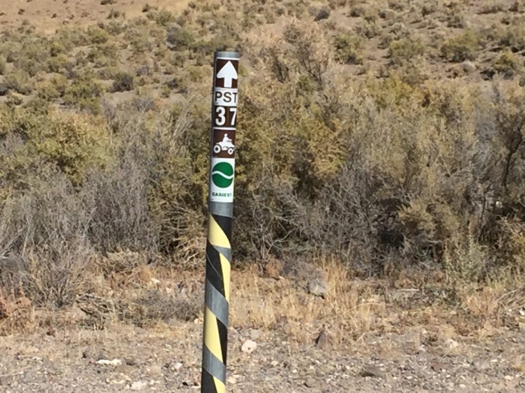
We will take the old rive road aka Trail 37 south. Look for it right behind the town dumpsters after you cross the river.
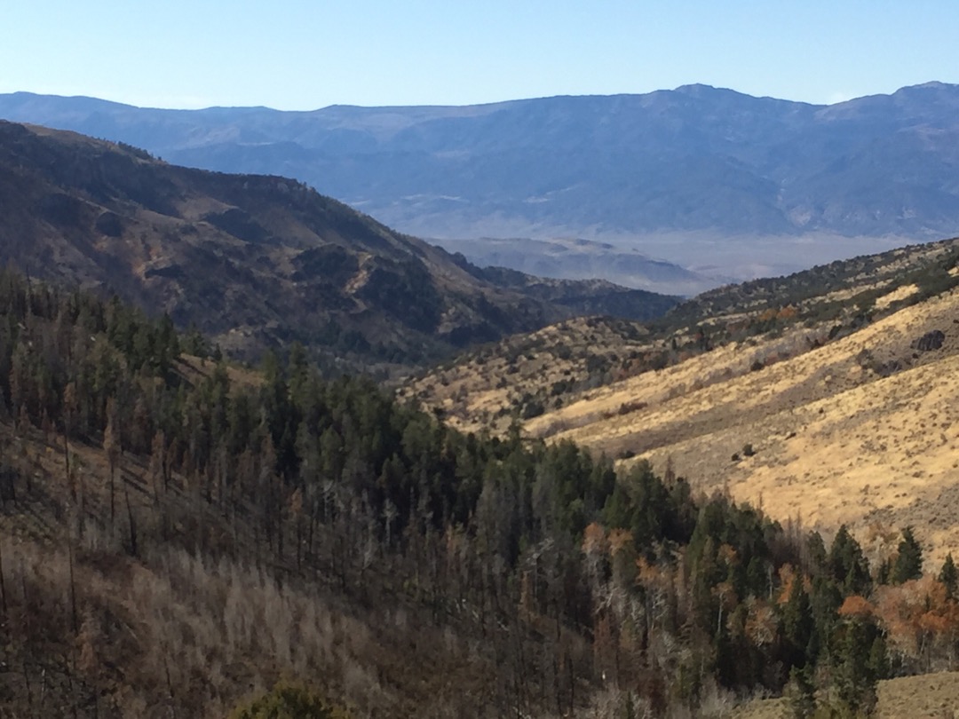
The meandering Sevier river and soaring mountains of the Tushars. The kind of view that inspires a song.
Those blue table mountains in the distance are our destination today.
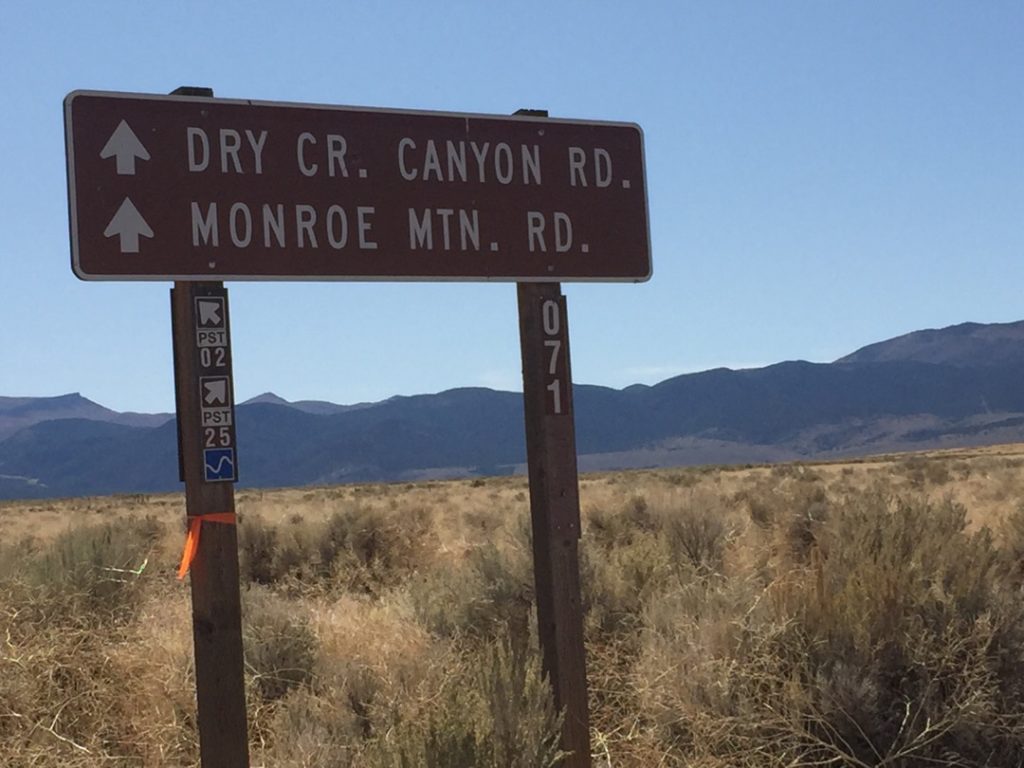
Switchbacks in Dry Creek Canyon take us up the mountain quickly. watch for oncoming traffic this is one of the 1.5 lane roads.
Very soon we have left the sagebrush and sand for forest and fall colors.
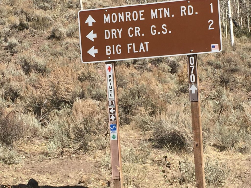
We are going to take the left turn for a bit. We will be back past here soon.
We really wanted to show you the top of Big Table Mountian but it appears the USFS has recently restricted access to 50″ or less. To narrow for the Ranger. Maybe later we will come back with the RZR.
We backtracked on trail 01 to hop on Paiute Trail 01 and head south.
The top of the Forsheas are defined by massive mountain meadows broken by occasional Pine forest.
On the south end of the Forshea we decide to take the path less traveled. Known as the ‘Pipeline Trail’. Those in rigs wider than our Ranger or concerned about their pain job may not want to take this route. It is becoming overgrown and we had quite a bit of scratching from scrub oak trees and Junipers. There are a few obstacles that challenged our 64″ ranger to get past. If you are wider than this you may have problems.
The trail is becoming overgrown and more difficult.
The passage width between that large boulder and the tree on the right is about 64″ (after we trimmed the tree).
It’s a shame there is no nice view 🙂
One Last Aspen forest before we head home.
You could stay on 01 to the left or drop back towards Marysvale on trail 25 via Cottonwood Canyon.
Here is a photo gallery of all of the Images we took along the way. Not necessarily in any order or sequence. Many are at trail intersections. You can see the photos and exactly where along the trail where taken: Click here for Photo Locations.


Emergencies
The closest medical help is Ashley Regional Medical Cente 150 W 100 N, Vernal, UT 84078 Dial 911 for Emergencies or (435) 789-3342
Piute County Sheriff’s Office 550 N Main St, Junction, UT 84740 Dial 911 for Emergencies or (435) 577-2893
Utah Highway Patrol Dial 911 835 E 300 N Suite 600, Richfield, UT 84701 (435) 896-2780
Fishlake National Forest 115 E 900 N, Richfield, UT 84701 (435) 896-8452

