

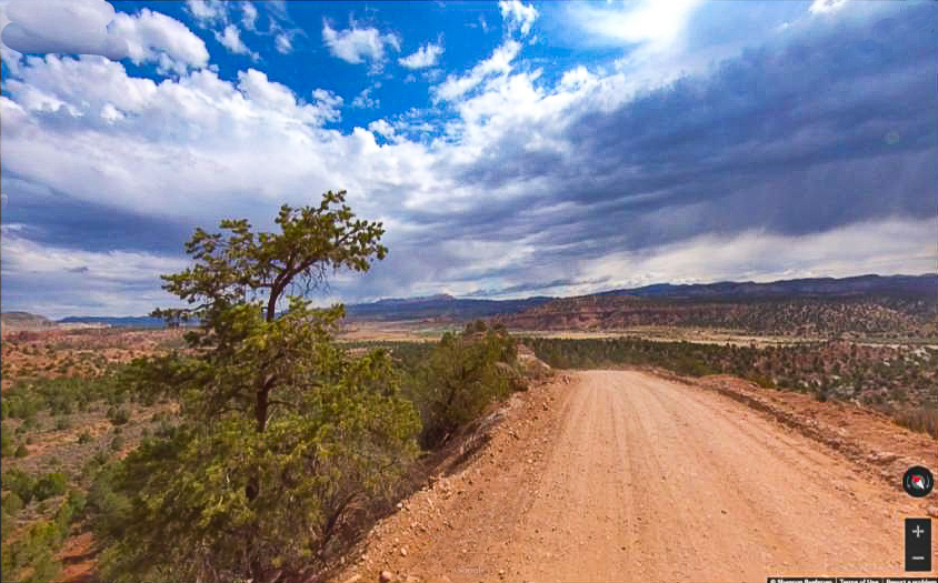
The Skutumpah to Tropic Backcountry Road is the scenic route through the Grand Staircase-Escalante National Monument that connects Highway 89 in Kanab and Highway 12 in Tropic. This route is a well maintained county road but can quickly become impassable during inclement weather. High clearance and 4WD is recommended because it’s 85 miles before you will come across any services. We ran the road in four hours but plan a little extra time if you plan on exploring or taking photos.
Both Kanab and Tropic have the amenities you need for a the perfect basecamp for your trip. We recommend booking your lodging or camping ahead of time because this is a popular area during the spring and summer vacation season. This is a great route to tack onto your vacation if you are planning on visiting Kodachrome State Park, Coral Pink Sand Dunes State Park or the nearby Zion or Bryce National Parks. You will find that the Skutumpah road is a welcome contrast to those more crowded attractions.
- Directions
- Facilities: There are a variety of options for lodging, camping, restaurants, fuel and groceries in Kanab 30 miles from the trailhead. Other nearby communities include Glendale, Orderville and Mt. Carmel Junction. There are no services along the Skutumpah Road. Tropic has places to stay the night, some restaurants, groceries and fuel.
- OHVs: All sizes. No width limits. ATVs, MCs, UTVs, 4x4s on most trails.
- Terrain: Maintained county road.
- Signage: Trail is well signed.
- KML File for Google Maps
- GPX File for your Garmin GPS or other Apps
- Emergencies: Garfield Memorial Hospital 200 N 400 E Panguitch, UT 84759 (435) 676-8811
- Kane County Sheriff: Dial 9-1-1 for emergencies or Non-Emergency Dispatch: (435) 644-2349; Garfield County Sheriff: Dial 9-1-1 for emergencies or Non-Emergency (435) 676-2678. We highly recommend you purchase a Utah Search and Rescue Assistant Card (USARA) learn more: https://secure.utah.gov/rescue/
GAIA
We highly recommend you get GAIA GPS for your mobile device. GAIA GPS will allow you to download this trail complete with the photos you see here so you can be sure where you are at all times. Simply install the GAIA GPS app and save this trail from the button below.
Here is the 360 view at the trailhead. Feel free to tour around a bit inside Google Street Views. We have recorded the trail in 360 and it is now part of Google Street Views so you can take a virtual tour of the trail to see if it is for you. We’ve made it a bit easier to navigate, scroll down and you will see more 360 embedded tours as we encounter intersections, trail markers or interesting places along the trail.
On any image, you can click the ‘X’ in the upper right corner and the view will change to an overview map showing the Google Street View blue lines. You can click anywhere on that blue line and drop down to the 360 ground-level views at that point.
You can move the image 360 degrees, click the arrow to move further down the trail and zoom in and out to take a closer look. Clicking the box in the upper right-hand corner will enlarge to full screen for a better view.

