

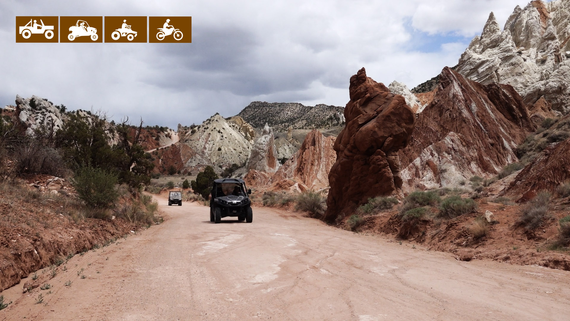
Cottonwood Canyon is a 50-mile road from US 89 east of Kanab to Highway 12 at Cannonville. It provides access to numerous Jeep trails and hiking trails, as well as Candyland, Grosvenor Arch and The Cockscomb.
It took us four hours to drive this road from Highway 89 to our stop in Tropic. Tropic serves as a great destination at the end of the trail where you will find lodging, restaurant, and fuel.
We would rate this as an intermediate trail because of the distance and proximity to services. Take plenty of water, spare tire/tools and let people know where you are going/when you plan to return. Most of the trail is a maintained county road but there are some rocky sections and wash-boarding is common if it’s been a while since the road has been graded.
- Directions
- Facilities: There are a variety of options for lodging, camping, restaurants, fuel and groceries in Kanab, 47 miles from the trailhead. There are no services along the Cottonwood Road. Tropic has lodging, food and supplies at the end of your ride.
- All sizes. No width limits. ATVs, MCs, UTVs, 4x4s on most trails.
- Terrain: Maintained county roads can become impassable in inclement weather.
- Signage: The main routes have adequate signage.
- KML File for Google Maps
- GPX File for your Garmin GPS or other Apps
- Emergencies: Garfield Memorial Hospital 200 N 400 E Panguitch UT 84759 435-676-8811 or the Kane County Hospital 355 N. Main, Kanab, UT 84741 EMERGENCY Dial 9-1-1
- Sheriff: Kane County Sheriff: Dial 9-1-1 for emergencies or Non-Emergency Dispatch: (435) 644-2349 Garfield County Sheriff: Dial 9-1-1 for emergencies or Non-Emergency (435) 676-2678 We highly recommend you purchase a Utah Search and Rescue Assistant Card (USARA)
GAIA
We highly recommend you get GAIA GPS for your mobile device. GAIA GPS will allow you to download this trail complete with the photos you see here so you can be sure where you are at all times. Simply install the GAIA GPS app and save this trail from the button below.
Here is the 360 view at the trailhead. Feel free to tour around a bit inside Google Street Views. We have recorded the trail in 360 and it is now part of Google Street Views so you can take a virtual tour of the trail to see if it is for you. We’ve made it a bit easier to navigate, scroll down and you will see more 360 embedded tours as we encounter intersections, trail markers or interesting places along the trail.
On any image, you can click the ‘X’ in the upper right corner and the view will change to an overview map showing the Google Street View blue lines. You can click anywhere on that blue line and drop down to the 360 ground-level views at that point.
You can move the image 360 degrees, click the arrow to move further down the trail and zoom in and out to take a closer look. Clicking the box in the upper right-hand corner will enlarge to full screen for a better view.

