

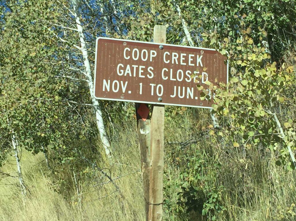
The Currant Creek OHV Trailhead is available seasonally (closed Nov. 1 to June 30th by gate). The trailhead is right off State Route 40 North of Strawberry Reservoir on forest route 082. We spent four hours riding 50 miles of trail at about 13 mph. Plan this trip as a half-day ride or leave some additional time for additional exploration in the area. We’ve included the GPS track and 360 views from the trail below to help you plan your trip.
- Directions From the North
- Directions from the South
- Facilities: Vault toilet at the trailhead; kodging, camping, gas and groceries in nearby Heber City or Duchesne. Camping and boating at nearby Strawberry Reservoir. *Some campgrounds may prohibit ATVs.
- OHVs: All sizes. No width limits. ATVs, MCs, UTVs, 4x4s on most trails.
- Signage: Most trails have adequate signage.
- KML File for Google Maps
- GPX File for your Garmin GPS or other Apps
We highly recommend you get GAIA GPS for your smartphone or tablet mobile device. GAIA GPS will allow you to download this trail complete with the photos you see here so you can be sure where you are at all times. Simply install the GAIA GPS app and save this trail from here: DOWNLOAD THIS TRAIL
Here is an embedded live link to GAIA GPS to allow you to explore the trail. Each of the blue markers indicates that a photo was taken at that location. To view the track and photos click here: GAIA GPS – Currant Creek OHV Trail – Wasatch CO Utah
Would you like to see the trail in an animated 3D flyover map? If it appears to pause that is likely a place we stopped for a while. It will continue, just wait a few moments. Link to 3D flyover.
Here is the 360 view at the trailhead. Feel free to tour around a bit inside Google Street Views. We have recorded the trail in 360, and it is now part of Google Street Views so you can take a virtual tour of the trail to see if it is for you. While we didn’t have time to ride all of the trail we think you will find this fairly representative of what you will find. We’ve made it a bit easier to navigate, scroll down and you will see more 360 embedded tours as we encounter intersections, trail markers or interesting places along the trail.
On any image, you can click the ‘X’ in the upper right corner and the view will change to an overview map showing the Google Street View Blue lines. You can click anywhere on that blue line and drop down to the 360 ground-level views at that point.
You can move the image 360 degrees, click the arrow to move further down the trail and zoom in and out to take a closer look. Clicking the box in the upper right-hand corner will enlarge to full screen for a better view.
There is a large parking area with plenty of room to unload near highway 40. You can see Strawberry Reservoir on the other side of the highway.
Access to the trail is gated off from Nov. 1 to June 30.
Follow the sign for Currant Creek, turning right to continue on forest route 082
Turn right to head to Currant Creek Reservoir and Campground (ATVs are prohibited in the campground). You may see a beaver dam off the road at the north end of the lake. Turning left will take you along the loop we rode.
This looks like a nice campground but be aware ATVs are prohibited in the campground. This is where we turned around.
Turn left here to follow forest route 106.
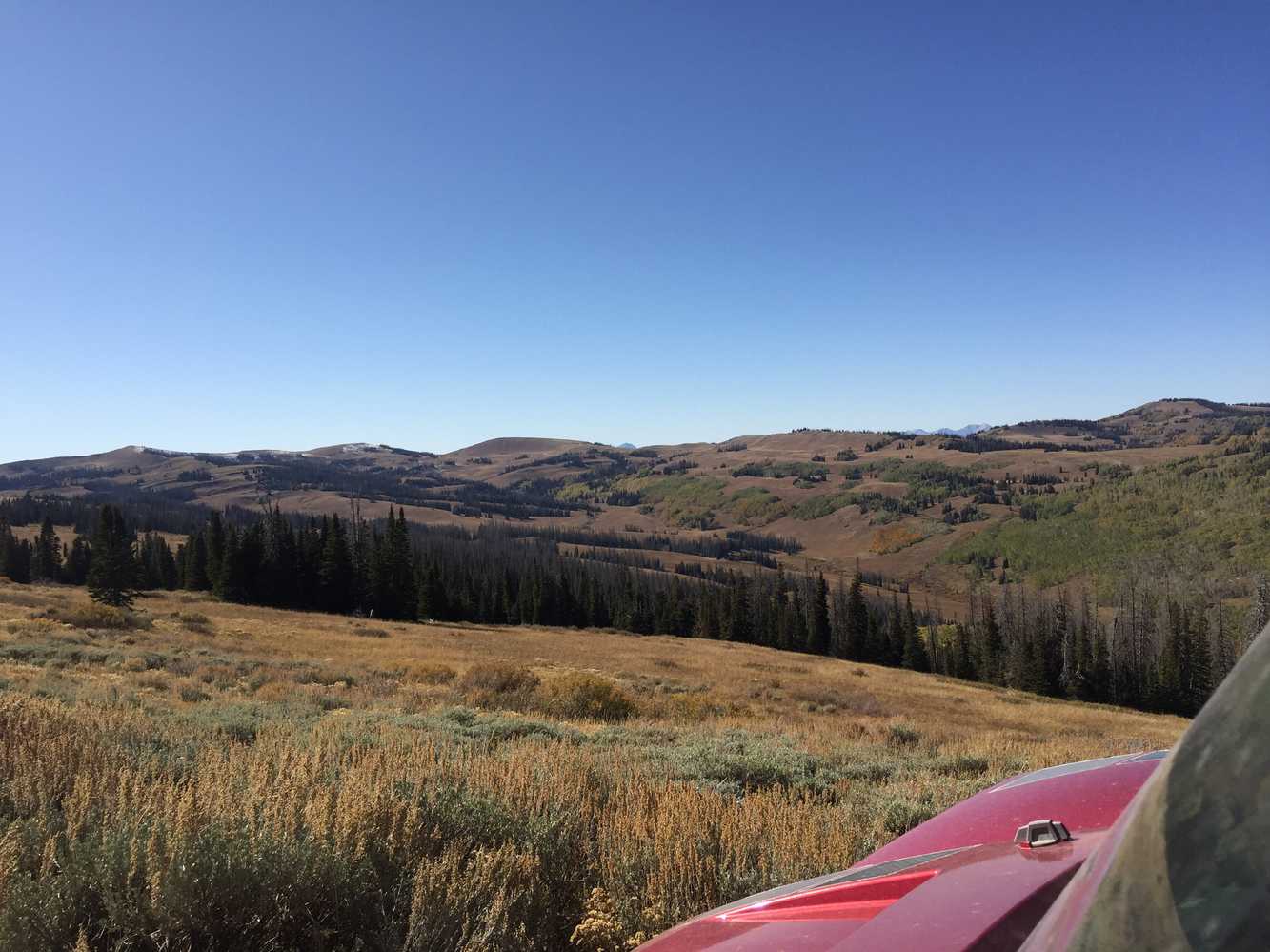
Looking north toward Death Hollow and Corral Hollow.
Looking southeast Currant Creek Reservoir in the distance.
Riding through the aspens on the way back to highway 40.
Here is a photo gallery of all of the images we took along the way. Not necessarily in any order or sequence. Many are at trail intersections. You can see the photos and exactly where along the trail where taken: Click here for Photo Locations.


Emergencies
The closest medical help is the Heber Valley Hospital, 454 East Medical Way Heber City, UT 84032. (435) 654-2500 or Uintah Basin Medical Center, 250 W 300 N, Roosevelt, UT 84066 (435) 722-4691
Wasatch County Sheriff: Dial 9-1-1 for emergencies or non-emergency dispatch: (435) 654-1411
Utah Highway Patrol: Dial 9-1-1
We highly recommend you purchase a Utah Search and Rescue Assistant Card (USARA), learn more: https://secure.utah.gov/rescue/

