

Ute Mountain OHV Trail will take you to the last standing fire tower with a living quarters in Utah. The trailhead is right off the highway UT-44, 20 minutes south of Manila, Utah. We road 50 miles on the trail in about five hours at an average speed of 10 mph. Our first stop was the Ute Mountain Fire Tower but there are a number of side trails and areas to explore in the surrounding area, read our remarks below and take a 360 view of the trail to see some of our stops. The trail offers great views of the High Uintahs and is close to Flaming Gorge.
- Directions From the North
- Directions from the South
- Facilities: Lodging, camping, fuel and supplies are all available in nearby Manila; primitive camping and vault toilet available along the trail
- OHVs: Some width limits. ATVs, MCs, UTVs, 4x4s on most trails. Some trailheads are exclusive to non-motorized. Please pay attention to signs and stay on the trail.
- Terrain: Mostly graded county toads; some 50″ ATV trails
- Signage: The trails in this area are well marked with additional kiosks and information placards at points of interest.
- KML File for Google Maps
- GPX File for your Garmin GPS or other Apps
We highly recommend you get GAIA GPS for your smartphone or tablet mobile device. GAIA GPS will allow you to download this trail complete with the photos you see here so you can be sure where you are at all times. Simply install the GAIA GPS app and save this trail from here: DOWNLOAD THIS TRAIL
Here is an embedded live link to GAIA GPS to allow you to explore the trail. Each of the blue markers indicates that a photo was taken at that location. To view the track and photos click here: GAIA GPS – Ute Mountain – Daggett CO Utah
Would you like to see the trail in an animated 3D flyover map? If it appears to pause that is likely a place we stopped for a while. It will continue, just wait a few moments. Link to 3D flyover.
Here is the 360 view at the trailhead. Feel free to tour around a bit inside Google Street Views. We have recorded the trail in 360, and it is now part of Google Street Views so you can take a virtual tour of the trail to see if it is for you. While we didn’t have time to ride all of the trail we think you will find this fairly representative of what you will find. We’ve made it a bit easier to navigate, scroll down and you will see more 360 embedded tours as we encounter intersections, trail markers or interesting places along the trail.
On any image, you can click the ‘X’ in the upper right corner and the view will change to an overview map showing the Google Street View Blue lines. You can click anywhere on that blue line and drop down to the 360 ground-level views at that point.
You can move the image 360 degrees, click the arrow to move further down the trail and zoom in and out to take a closer look. Clicking the box in the upper right-hand corner will enlarge to full screen for a better view.
This is the trailhead there is some parking and space to unload just off the highway.
Stay right at the sign for Elk Park Trails 013 & 014 heading west. We will visit this point later in the ride.
Continue heading west. The Deep Creek Campground is to the right. There are some good camp spots up the loop as well as a vault toilet. Find out more here: https://www.fs.usda.gov/recarea/ashley/recarea/?recid=72263
Turning left will take you on the trail to the Ute Mountain Fire Watch Tower.
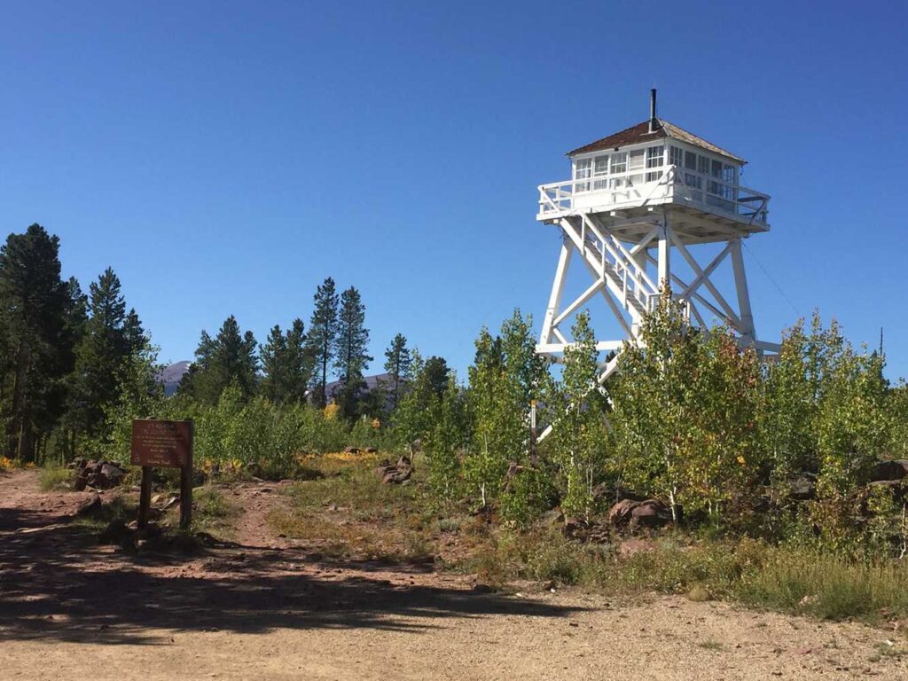
This is a cool stop. The Ute Mountain Fire Lookout was the first and remains as the last tower with living quarters in Utah. Learn more about this site: https://www.fs.usda.gov/detail/ashley/learning/history-culture/?cid=fsm9_002410
Stay heading west. There is a pull off to the right and a trailhead for another ATV trail (route 166).
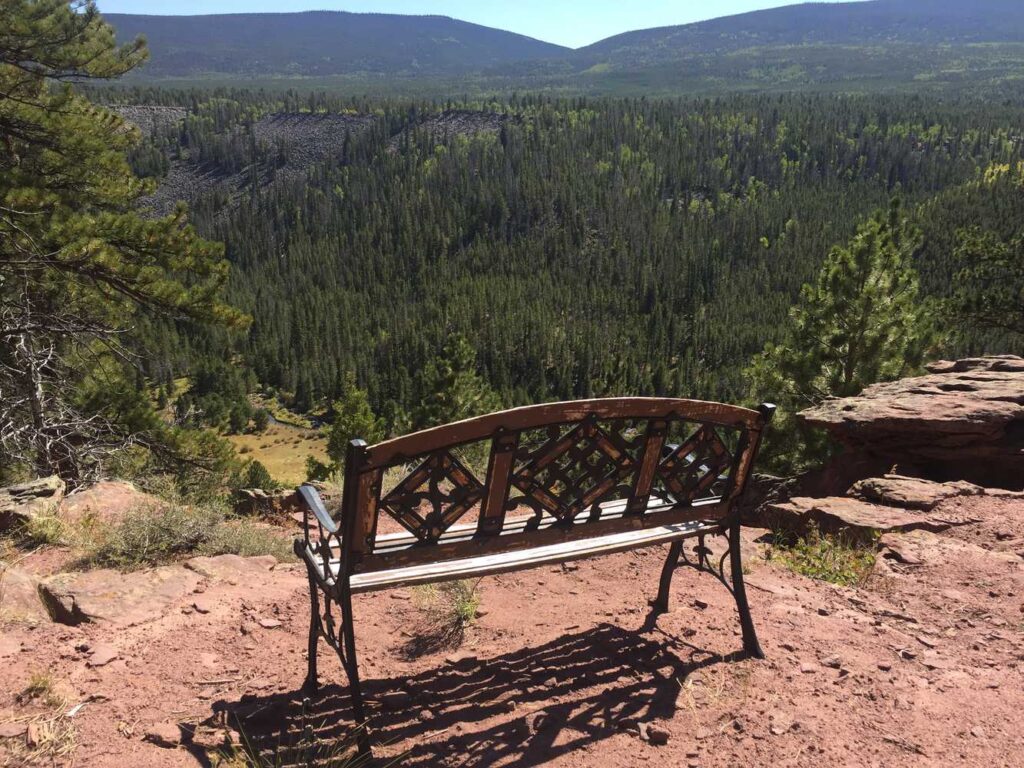
Cruising past Half Moon Park. Keep an eye out for wildlife.
Turn left here to head south.
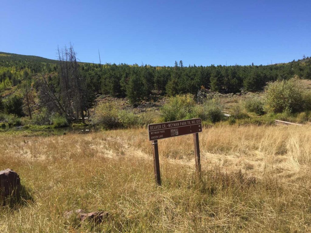
Beaver Cr. – Weyman Park Trail
Browne Lake. There is also a campground nearby (Browne Lake Campground), but we were a little late in the season so the gates were locked. More info: https://www.fs.usda.gov/recarea/ashley/recarea/?recid=72185
We found hiking trailheads for Tepee Lake, Red Lake, Leidy Peak, Lost Lake Trail and Lost Lake at the end of this trail.
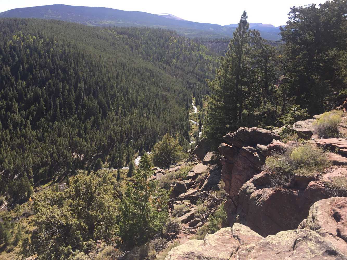
Carter Creek is just over the ridge. Carter Creek runs right into Flaming Gorge and offers some amazing fly fishing.
Another vantage point looking down into Carter Creek at the end of forest road 628.
On the way back, we took this side road out to Scraper Spring and Elk Park.
Here is a photo gallery of all of the images we took along the way. Not necessarily in any order or sequence. Many are at trail intersections. You can see the photos and exactly where along the trail where taken: Click here for Photo Locations.


Emergencies
The closest medical help is Ashley Regional Medical Center, 150 W 100 N, Vernal, UT 84078. Dial 9-1-1 for emergencies or (435) 789-3342
Daggett County Sheriff’s Office: Dial 9-1-1 for emergencies or (435) 784-3255
Utah Highway Patrol: Dial 9-1-1
Ashley National Forest: 355 North Vernal Avenue Vernal, UT 84078 (435) 789-1181
We highly recommend you purchase a Utah Search and Rescue Assistant Card (USARA), learn more: https://secure.utah.gov/rescue/

