

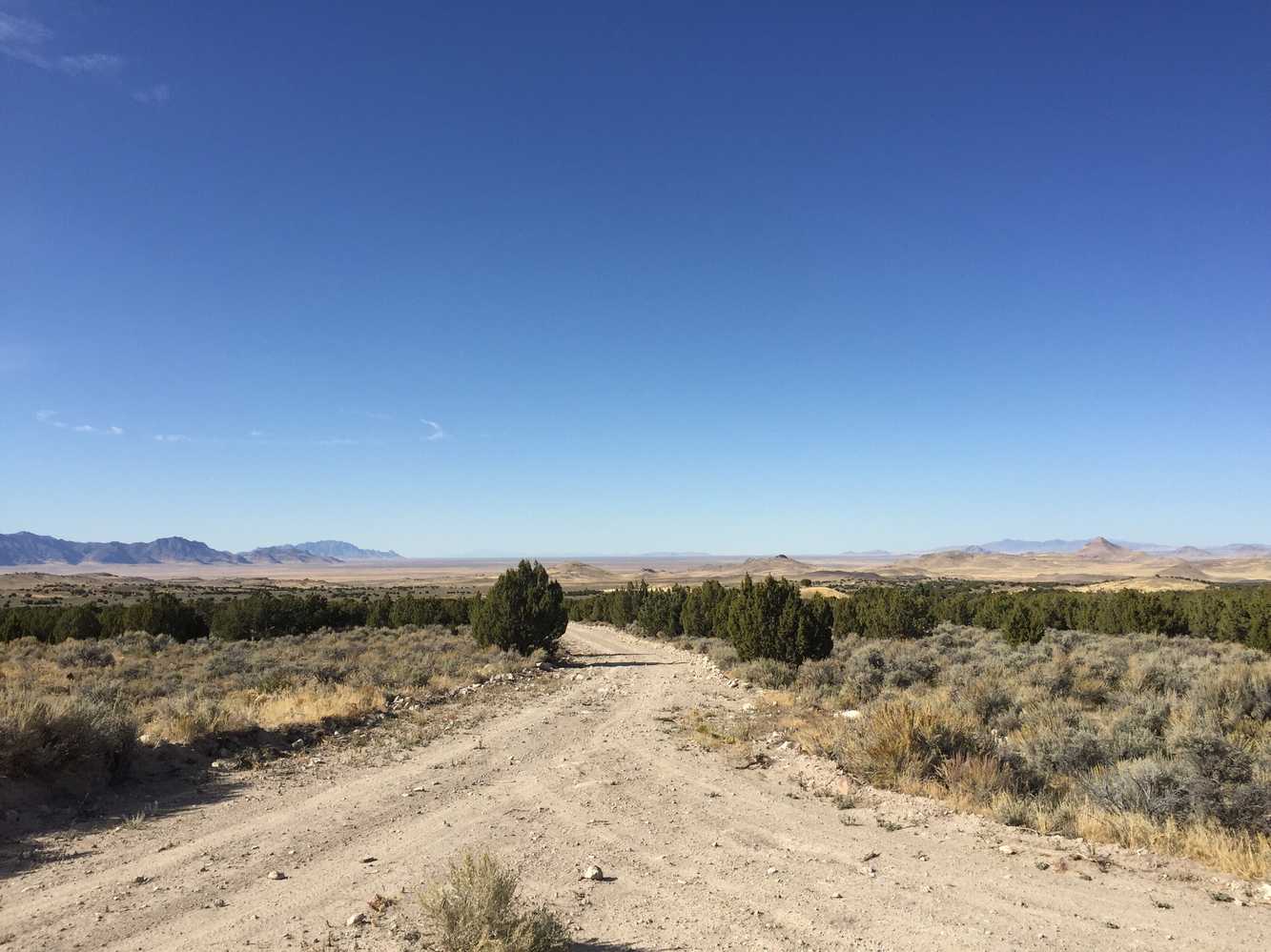
The Slow Elk Hills trail is along the Historic Pony Express Route in Utah’s West Desert between Tooele and Juab Counties. This 56-mile trail circles Table Mountain and Cup Butte. The Great Basin Region is miles and miles of nothing but miles and miles; with interesting places to explore for those who love the desert. We spent 3.5 hours riding at an average speed of 16 mph. Plan at least five hours to allow for some additional exploration, and plan your trip so you can grab a bite and explore one of the towns nearby.
Speaking of nearby towns, there are no services in the immediate area and this is the desert so stock up on water and other supplies in Tooele, Eureka, Nephi or Delta (depending on where you are coming from). Make sure someone knows where you are going and map out your trail with the resources here.
- Directions From the North
- Directions from the South
- Facilities: This ride is OUT in the desert. Let people know where you are going and when you plan to return. Bring plenty of water, food, tools and make sure you have a good spare tire. You can stock up on gas and supplies in Tooele, Eureka, Nephi or Delta (depending on which direction you are coming from). There is a small campground and vault toilet at the Pony Express Historical Marker.
- OHVs: All sizes. No width limits. ATVs, MCs, UTVs, 4x4s on most trails.
- Terrain: Easy – Mostly graded county roads with some two-track.
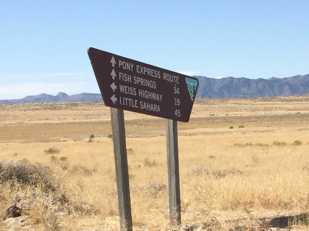
- Signage: The main routes have adequate signage but some trails aren’t very clear where they go. This is a good place to have a GPS.
- KML File for Google Maps
- GPX File for your Garmin GPS or other apps
We highly recommend you get GAIA GPS for your smartphone or tablet mobile device. GAIA GPS will allow you to download this trail complete with the photos you see here so you can be sure where you are at all times. Simply install the GAIA GPS app and save this trail from here: DOWNLOAD THIS TRAIL
Here is an embedded live link to GAIA GPS to allow you to explore the trail. Each of the blue markers indicates that a photo was taken at that location. To view the track and photos click here: GAIA GPS – Slow Elk Hills
Would you like to see the trail in an animated 3D flyover map? If it appears to pause that is likely a place we stopped for a while. It will continue, just wait a few moments. Link to 3D flyover.
Here is the 360 view at the trailhead. Feel free to tour around a bit inside Google Street Views. We have recorded the trail in 360, and it is now part of Google Street Views so you can take a virtual tour of the trail to see if it is for you. While we didn’t have time to ride all of the trail we think you will find this fairly representative of what you will find. We’ve made it a bit easier to navigate, scroll down and you will see more 360 embedded tours as we encounter intersections, trail markers or interesting places along the trail.
On any image, you can click the ‘X’ in the upper right corner and the view will change to an overview map showing the Google Street View Blue lines. You can click anywhere on that blue line and drop down to the 360 ground-level views at that point.
You can move the image 360 degrees, click the arrow to move further down the trail and zoom in and out to take a closer look. Clicking the box in the upper right-hand corner will enlarge to full screen for a better view.
Head southwest from Simpson Springs Station Historic Pony Express Marker. There is a primitive campground nearby if you plan on sleeping out under the stars.
Table Mountain rises from the desert floor 846 feet and an elevation of 5,766 feet.
There are a number of places to explore along the historic Pony Express route. We continue southward toward Table Mountain.
Keep left at the fork.
Stay on the main road here. The two-track to your right eventutally disappears into the desert up over the hill. The two-track to the left (north) continues on to Slow Elk Hills but the Flint Spring Road (main road you just left) circles back and around to the same spot.
Turn right and continue heading south at this intersection.
Continue east at this intersection.
You will find a trail that takes off from the main road to your right shortly after the cattleguard.
You will come to another intersection, stay left.
You will come back to the graded road. Continue right (south) on the diagonal to Keg Pass Road. If you watch the track via Ayvri (above) you will see where we circled back to where we originally took off from the main road.
Hang left continuing north at this intersection.
Stay left northwest at this intersection. Continuing on to Simpson Springs Callao Road back to the Pony Express historical marker.
Here is a photo gallery of all of the images we took along the way. Not necessarily in any order or sequence. Many are at trail intersections. You can see the photos and exactly where along the trail where taken: Click here for Photo Locations.


Emergencies
The closest medical help is Central Valley Medical Center in Nephi, 48 W 1500 N, Nephi, UT 84648. (435) 623-3000. The center is 31 miles south and east on Jericho-Callao Road across HHY 6 to Rd 132. Dial 9-1-1 for emergencies.
Juab County Sheriff Department: Dial 9-1-1 or (435) 623-1349.
Tooele County Sheriff Department: Dial 9-1-1 or (435) 882-5600.
Utah Highway Patrol – Nephi: (435) 623-1018
BLM Office at Little Sahara Recreation area: (435) 433-5960
We highly recommend you purchase a Utah Search and Rescue Assistant Card (USARA). Learn more: https://secure.utah.gov/rescue/

