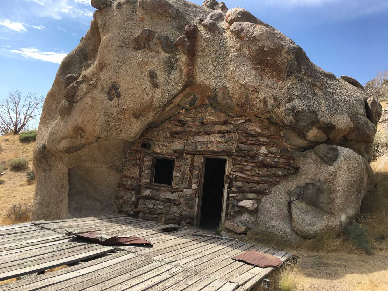
The Beaver to Chocolate Drop House trail is an easy ride in the mountains with several interesting things to see along the way. This trail takes you to the Chocolate Drop House also known as “Rock Cabin” (pictured above). This structure was built by a craftsman in the early 1900s. The cabin is built in a hollow section of a very large boulder. The ride then loops down around Granite Peak and back to Beaver. The entire loop is 76 miles and took us 4.5 hours (moving) to complete. Plan for a full day for this ride because there are reservoirs to explore and places to stop for a nice picnic.
The terrain is mostly comprised of well-maintained dirt roads.
This trail provides great opportunities to branch off and explore different areas on the mountain. There are campsites and picnic areas along the way.
You can also find just about every amenity you need including gas, lodging and food in the town of Beaver.
GAIA
We highly recommend you get GAIA GPS for your mobile device. GAIA GPS will allow you to download this trail complete with the photos you see here so you can be sure where you are at all times. Simply install the GAIA GPS app and save this trail from the button below.
- Directions From the North
- Directions from the South
- Facilities: Lodging, restaurants, fuel and groceries are available in the town of Beaver
- OHVs: Mostly OHV trail-style riding.
- Terrain: Mostly dirt trails - some rocky areas. Mostly OHV trail-style riding.
- Signage: signs at most intersections noting distance to landmarks and direction of travel.
- KML File for Google Maps
- GPX File for your Garmin GPS or other Apps
- Emergencies: Beaver Valley Hospital: 1109 100 W St, Beaver, UT 84713
- Beaver County Sheriff's Department: Dial 9-1-1 for emergencies or Non-Emergency Dispatch: 435-438-2862. We highly recommend you purchase a Utah Search and Rescue Assistant Card (USARA) learn more: https://secure.utah.gov/rescue/
Here is the 360 view at the trailhead. Feel free to tour around a bit inside Google Street Views. We have recorded the trail in 360 and it is now part of Google Street Views so you can take a virtual tour of the trail to see if it is for you. We’ve made it a bit easier to navigate, scroll down and you will see more 360 embedded tours as we encounter intersections, trail markers or interesting places along the trail.
On any image, you can click the ‘X’ in the upper right corner and the view will change to an overview map showing the Google Street View blue lines. You can click anywhere on that blue line and drop down to the 360 ground-level views at that point.
You can move the image 360 degrees, click the arrow to move further down the trail and zoom in and out to take a closer look. Clicking the box in the upper right-hand corner will enlarge to full screen for a better view.
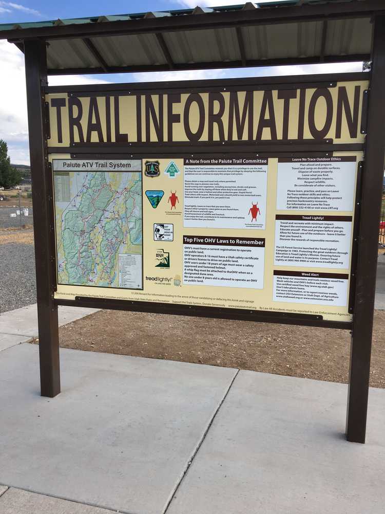
There is some good trail information on this sign in Beaver.