

Big Water, Utah is a small town 17 miles northwest of Page, Arizona on US-89 near Lake Powell and the Glen Canyon Dam. This 85-mile trail boasts a landscape that is “out of this world” as you ride north through the Grand Staircase – Escalante National Monument. We spent five hours riding at an average speed of 16 mph.
There are no services and this is the desert so stock up on water and other supplies in Big Water or on your way through Kanab. Make sure family and friends know where you are going and map out your trail with the resources here.
- Directions From the North
- Directions from the South
- Facilities: There are a few motels out of Big Water, Utah and fuel toward Page, AZ. You can stock up on fuel and groceries in Kanab.
- OHVs: All sizes. No width limits. ATVs, MCs, UTVs, 4x4s on most trails.
- Signage: Most trails have adequate signage. We recommend sticking to Smoky Mountain Road (graded road)
- KML File for Google Maps
- GPX File for your Garmin GPS or other Apps
We highly recommend you get GAIA GPS for your smartphone or tablet mobile device. GAIA GPS will allow you to download this trail complete with the photos you see here so you can be sure where you are at all times. Simply install the GAIA GPS app and save this trail from here: DOWNLOAD THIS TRAIL
Here is an embedded live link to GAIA GPS to allow you to explore the trail. Each of the blue markers indicates that a photo was taken at that location. To view the track and photos click here: GAIA GPS – Big Water to Escalante on Smoky Mtn Rd
Would you like to see the Big Water to Escalante trail in an animated 3D flyover map? If it appears to pause that is likely a place we stopped for a while. It will continue, just wait a few moments. Link to 3D flyover.
Here is the 360 view at the trailhead. Feel free to tour around a bit inside Google Street Views. We have recorded the trail in 360, and it is now part of Google Street Views so you can take a virtual tour of the trail to see if it is for you. While we didn’t have time to ride all of the trail we think you will find this fairly representative of what you will find. We’ve made it a bit easier to navigate, scroll down and you will see more 360 embedded tours as we encounter intersections, trail markers or interesting places along the trail.
On any image, you can click the ‘X’ in the upper right corner and the view will change to an overview map showing the Google Street View Blue lines. You can click anywhere on that blue line and drop down to the 360 ground-level views at that point.
You can move the image 360 degrees, click the arrow to move further down the trail and zoom in and out to take a closer look. Clicking the box in the upper right-hand corner will enlarge to full screen for a better view.
Head northeast toward Smoky Mountain Road / Grand Bench on National Park Road 230
Stay left (west) of the sign announcing the GSENM Border as you cross into the monument boundaries.
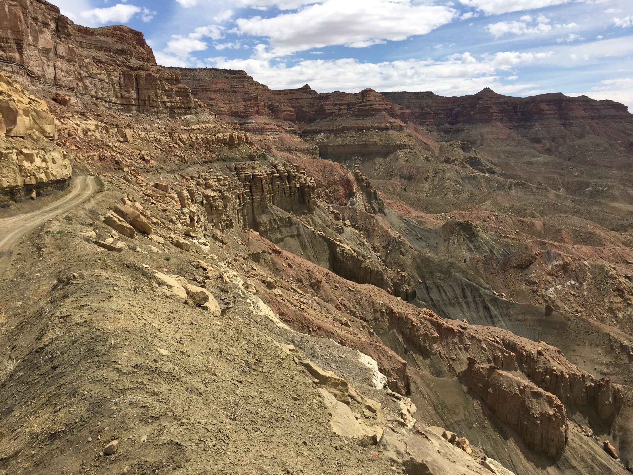
Starting up the Kelly Grade. Amazing colors in the hills created by a blue-purple clay layer called the Chinle formation. These clays were left by ancient lake, rivers and volcanic ash. Watch out when this stuff gets wet.
Continuing the climb of the Kelly Grade, along the Big Smoky Road (BLM 330)
From the top of the Kelly Grade
Continue on northwest on the main road. This turnoff will take you to the coal seam fires. Smokey Mountains have a coal seam burning deep within the mountain after being struck by lightning possibly thousands of years ago. https://geology.utah.gov/map-pub/survey-notes/geosights/geosights-smoky-mountain/
Stay on Smokey Mountain Road heading northwest
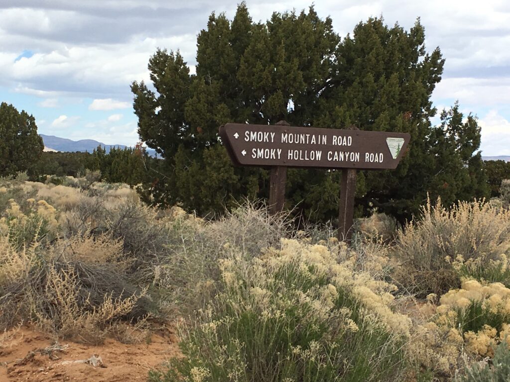
Continue on toward Escalante.
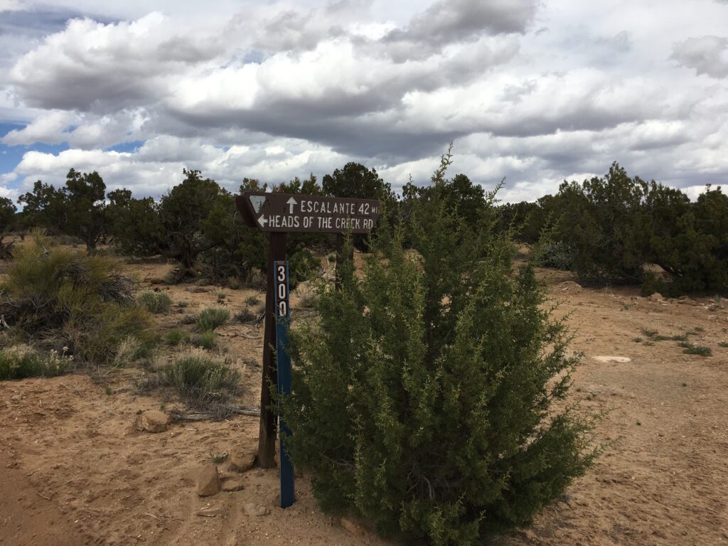
Head west continuing on to Escalante. You will find the Left Hand Collet Trail eastward.
Stay left (south) at the fork. To the right is a dead end at Camp Spring, just a short way off the main road.
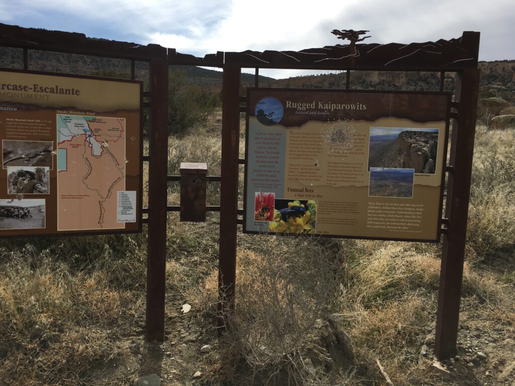
GSENM kiosk with some information about the area. From this point you are about three miles outside of Escalante. [37° 44.4185′ N 111° 37.6746′ W]
Here is a photo gallery of all of the images we took along the way. Not necessarily in any order or sequence. Many are at trail intersections. You can see the photos and exactly where along the trail where taken: Click here for Photo Locations.


Emergencies
The closest medical help is the hospital in Page AZ, 501 N Navajo Drive Road. Open 24 hours (928) 645-2424. Or the Kazan Memorial Clinic out of Escalante, 570 East Moqui Lane, Escalante, UT 84726 (435) 826-4374
Kane County Sheriff: Dial 9-1-1 for emergencies or Non-Emergency Dispatch: (435) 644-2349
Garfield County Sheriff: Dial 9-1-1 for emergencies or Non-Emergency (435) 676-2678
Utah Highway Patrol: Dial 9-1-1
We highly recommend you purchase a Utah Search and Rescue Assistant Card (USARA) learn more: https://gcutsheriff.com/search-rescue/

