

The Joshua Tree OHV trails are located in Washington County, Utah at the north end of Gunlock State Park. There is a place to stage at the trailhead, parking in the town of Gunlock or you can ride right out of Gunlock State Park if you are staying there.
This trail is 55 miles of graded road and some two-track through the desert. We spent 5 hours at an average speed of 10 mph riding. You can easily make this a full day trip taking some of the side roads exploring this remote corner of the state.
There are no services on the trail but you will drive right through St. George and Santa Clara to the trail so stock up on anything you need there.
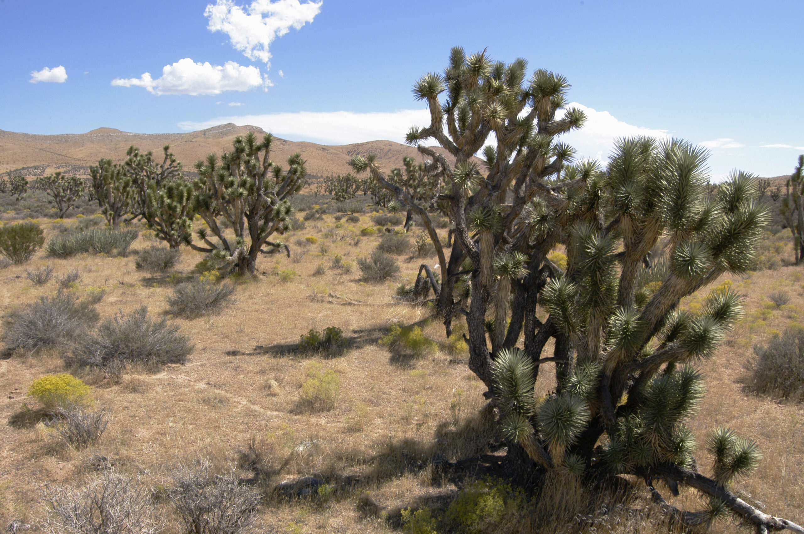
Riding would be generalized as easy going graded sandy roads with plenty of dust (this is the desert) and you will see Joshua trees.
- Directions From the North
- Directions from the South
- Facilities: Plenty of amenities as you drive through St. George and Santa Clara.
- You may encounter gates. Leave them as you find them.
- OHVs: All sizes. No width limits. ATVs, MCs, UTVs, 4x4s on most trails.
- Signing: Most trails have adequate signage
- KML File for Google Maps
- GPX File for your Garmin GPS or other Apps
We highly recommend you get GAIA GPS for your smartphone or tablet mobile device. GAIA GPS will allow you to download this trail complete with the photos you see here so you can be sure where you are at all times. Simply install the GAIA GPS app and save this trail from here: DOWNLOAD THIS TRAIL
Here is an embedded live link to GAIA GPS to allow you to explore the trail. Each of the blue markers indicates that a photo was taken at that location. To view the track and photos click here: GAIA GPS – Joshua Tree
Would you like to see the trail in an animated 3D flyover map? If it appears to pause that is likely a place we stopped for a while. It will continue, just wait a few moments. Link to 3D flyover.
Here is the 360 view at the trailhead. Feel free to tour around a bit inside Google Street Views. We have recorded the trail in 360, and it is now part of Google Street Views so you can take a virtual tour of the trail to see if it is for you. We’ve made it a bit easier to navigate, scroll down and you will see more 360 embedded tours where we encountered intersections, trail markers or interesting places along the trail.
On any image, you can click the ‘X’ in the upper right corner and the view will change to an overview map showing the Google Street View blue lines. You can click anywhere on that blue line and drop down to the 360 ground-level views at that point.
You can move the image 360 degrees, click the arrow to move further down the trail and zoom in and out to take a closer look. Clicking the box in the upper right-hand corner will enlarge to full screen for a better view.
Pull onto the trail at the north end of Gunlock State Park. This area will look different from when we were there last. You will see private property signs as you pull off the highway onto the road. There is private property (ride with respect) on either side of the road as you pull in. You can stage your ride from the state park or we found some area to park right off the highway where you will actually exit this ride. See the last Street View image of this entry to get a better look.
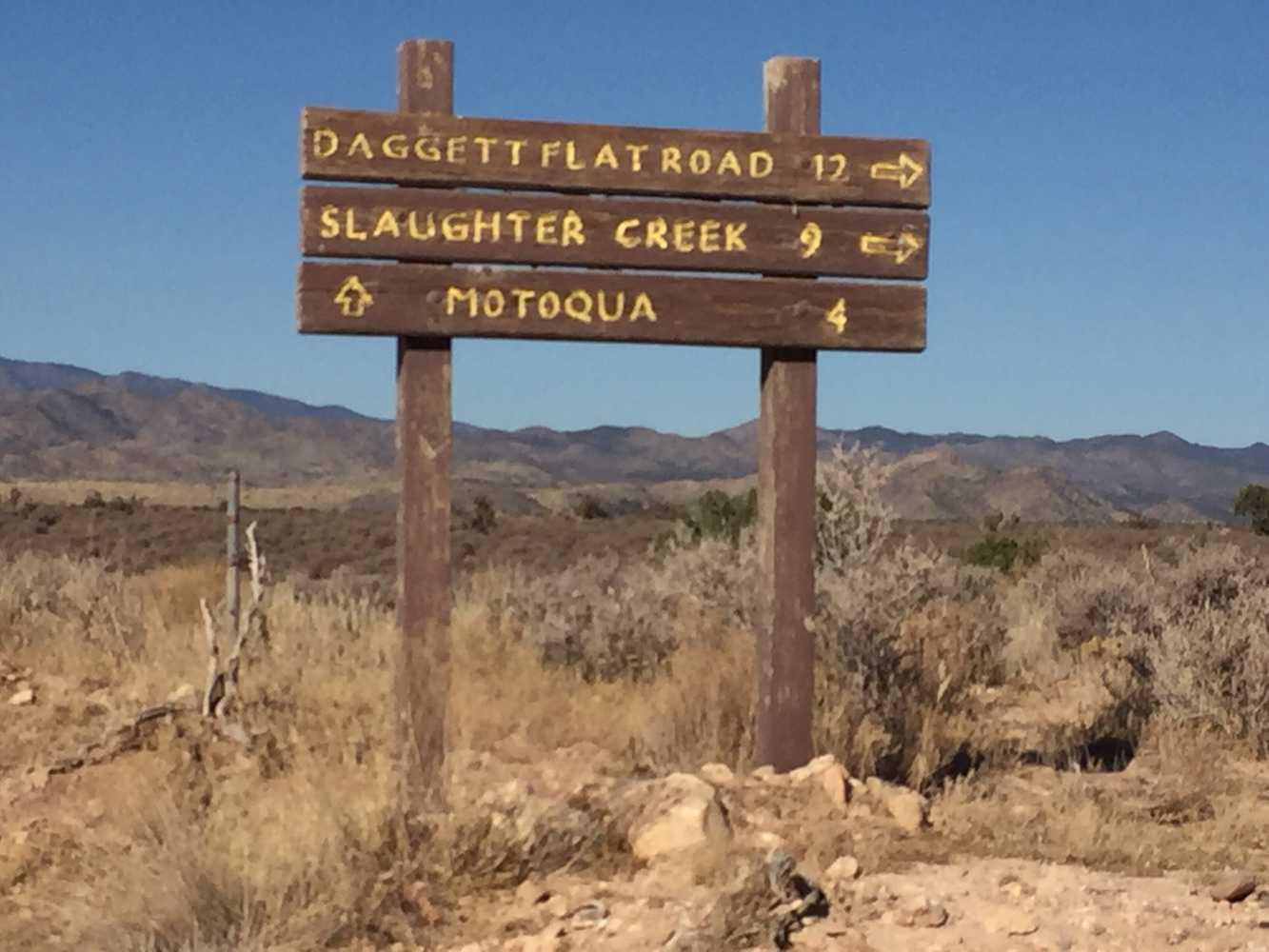
Stay on the main road heading toward Motoqua Road.
Keep to the left at the fork to stay on the main road. The spur to the right goes to a short loop through the junipers and some interesting sandstone formations.
There are a couple interesting places to setup camp off this spur.
Hang a right at Motoqua Road heading northwest.
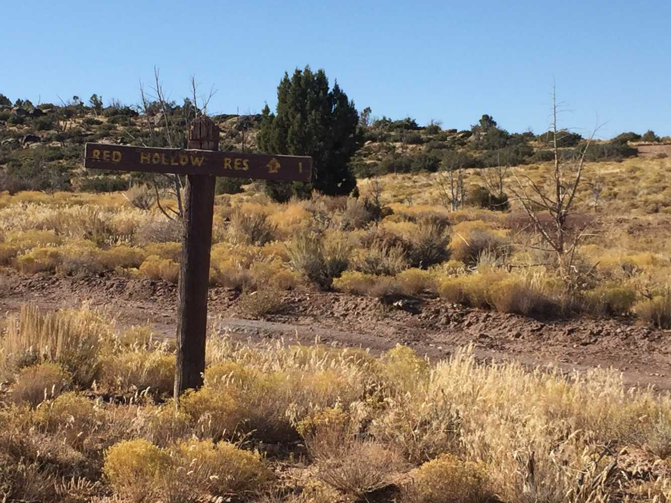
Red Hollow Reservoir sign (there is a sign for Red Hollow Reservoir off the main road 3.6 miles from where you turned onto Motoqua Road. It looks like it is dry most of the year but may come alive in the springtime).
Stay on Motoqua Road heading toward Motoqua.
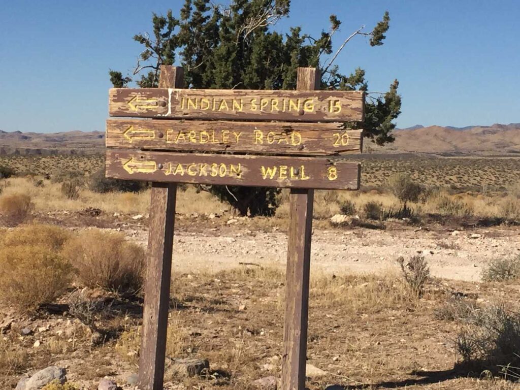
Head south following the sign for Indian Spring, Eardley Road and Jackson Well.
As you enter the valley, you will notice Joshua trees creeping up along the trail.
Entering the Beaver Dam Wash National Conservation Area. The road parallels the northern boundary of the designation.
You will need to cross a gate at this point. Please leave the gate as you found it, as ranchers run their cattle in the area. Continue straight on the trail heading slightly northeast.
Turn right (east) onto road 7993.
We don’t remember if we took a wrong turn or found this vantage point to enjoy the desert on purpose but this is a quiet spot a mile off the main road.
We’re back to Motoqua Road, turn right heading east.
The boundary to the Shivwits Paiute Indian Reservation. Please stay to the road and respect that you are entering private property for the next seven miles.
Back to the blacktop, turn left to head back to Gunlock.
Here is a photo gallery of all of the images we took along the way. Not necessarily in any order or sequence. Many are at trail intersections. You can see the photos and exactly where along the trail where taken: Click here for Photo Locations.


Emergencies
The closest medical help is St. George Regional Hospital. 1380 E Medical Center Drive, St George, UT 84790. (435) 251-1000, Dial 9-1-1 for emergencies.
Washington County Sheriff: 620 S 5300 W, Hurricane, UT 84737 (435) 656-6500. Dial 9-1-1 for emergencies.
Utah Highway Patrol: Dial 9-1-1

