

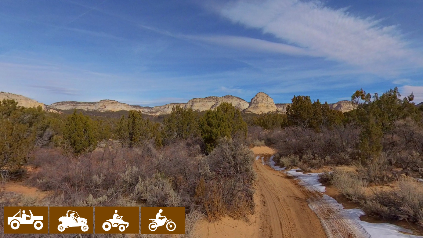
The Crocodile Loop OHV Trail is a 40 mile day ride on the smooth sandy trails that twist through the junipers and washes of the flats to the east of Highway 89. The spectacular white cliffs of the Grand Staircase lie in the distance to the north with some monoliths rising from the desert flat close to the trail waiting to be explored. Peekaboo Slot Canyon isn’t far from this route either. The sandy trails make for a smooth although dusty ride that the whole family ought to enjoy. It took us 4.5 hours to run the trail at approximately 9 mph.
Leave early if you are going to make this run in the summer. There are a few places to escape the sun among the rocks and junipers. However, this is a ride better suited for the early spring, fall or winter (the area looks very different when the sun lies farther south in the sky).
Kanab serves as a great basecamp, providing opportunities for lodging that will keep you close enough to the trailhead that you can both escape civilization for a ride but return for a hot shower and a meal.
This is an awesome ride to add to your itinerary if you are visiting nearby Coral Pink Sand Dunes State Park, Zion National Park and even St. George.
- Directions From the North
- Directions from the South
- Lodging, restaurants, fuel and groceries are all available in Kanab, Utah. There are some trailheads, pit toilets, and parking areas on the return trip of the loop as you cross back into Utah near the Vermillion Cliffs National Monument.
- OHVs: All sizes. No width limits. ATVs, MCs, UTVs, 4x4s on most trails.
- Sandy ATV trails with some overgrown junipers to squeeze through.
- There are some intersections that can be a little confusing that are marked with carsonite signage. Look at our notes below and download a GPS track (see below).
- KML File for Google Maps
- GPX File for your Garmin GPS or other Apps
- The closest medical help is the hospital in Kanab • 355 N. Main Street, Kanab UT 84741 (435) 644-5811 or in Page, AZ • 501 N Navajo Drive (928) 645-2424.
- Kane County Sheriff: Dial 9-1-1 for emergencies or Non-Emergency Dispatch: (435) 644-2349 • Utah Highway Patrol: Dial 9-1-1.
GAIA
We highly recommend you get GAIA GPS for your mobile device. GAIA GPS will allow you to download this trail complete with the photos you see here so you can be sure where you are at all times. Simply install the GAIA GPS app and save this trail from the button below.
Here is the 360 view at the trailhead. Feel free to tour around a bit inside Google Street Views. We have recorded the trail in 360 and it is now part of Google Street Views so you can take a virtual tour of the trail to see if it is for you. We’ve made it a bit easier to navigate, scroll down and you will see more 360 embedded tours as we encounter intersections, trail markers or interesting places along the trail.
On any image, you can click the ‘X’ in the upper right corner and the view will change to an overview map showing the Google Street View blue lines. You can click anywhere on that blue line and drop down to the 360 ground-level views at that point.
You can move the image 360 degrees, click the arrow to move further down the trail and zoom in and out to take a closer look. Clicking the box in the upper right-hand corner will enlarge to full screen for a better view.

