

The Red Knoll Loop is a short beginner trail. Families with young kids may enjoy going out for a little exploration without committing to a much longer ride. It’s also one of those rides you could tackle before the heat of the day sets in. At 5,900′ above sea level this is an area that remains cooler a little later into the spring if you miss the ideal dates for riding in the area. Typically those will be the most of the year with the exception of the summer.
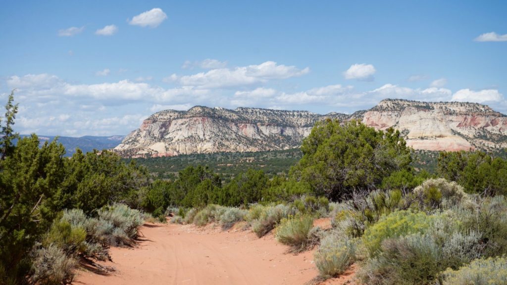
That being said, this is a ride for desert lovers. It’s a lot of juniper, pinyons, sagebrush and sand to look at. The trail does follow the boundary of the Parunuweap Canyon Wilderness Study Area so there are some opportunities to explore on foot but you will need to walk beyond the pinyons to see anything.
The Red Knoll Loop OHV Trail is off the main road heading toward Coral Pink Sand Dunes State Park, a short way off Highway 89. The trail is 30 miles and took us three hours to ride. Add in some time for exploring and you’ll have yourself a solid half-day ride.
Kanab and nearby Mt. Carmel Junction offer lodging, restaurants and supplies for your trip and serve as a good basecamp unless you choose to camp at Coral Pink State Park. Keep an eye on this area of the state because the opportunities for recreation are going to continue to expand as Kane County and private partners work together on the East Zion Initiative.
- Directions From the North
- Directions from the South
- Lodging, restaurants, fuel and groceries are all available in Kanab, Utah. Parking at the trailhead can be a little tricky because of the sand. There are no services available along the trail. OHVs: All sizes. No width limits. ATVs, MCs, UTVs, 4x4s on most trails.
- OHVs: All sizes. No width limits. ATVs, MCs, UTVs, 4x4s on most trails.
- Terrain: Sandy ATV trails with some overgrown junipers to squeeze through.
- Signage: There are some intersections that can be a little confusing that are marked with carsonite signage. Look at our notes below and download a GPS track (see below).
- KML File for Google Maps
- GPX File for your Garmin GPS or other Apps
- Emergencies: The closest medical help is the hospital in Kanab • 355 N. Main Street, Kanab UT 84741 (435) 644-5811 or in Page, AZ • 501 N Navajo Drive (928) 645-2424.
- Kane County Sheriff: Dial 9-1-1 for emergencies or Non-Emergency Dispatch: (435) 644-2349 • Utah Highway Patrol: Dial 9-1-1. We highly recommend you purchase a Utah Search and Rescue Assistant Card (USARA) learn more: https://secure.utah.gov/rescue/.
GAIA
We highly recommend you get GAIA GPS for your mobile device. GAIA GPS will allow you to download this trail complete with the photos you see here so you can be sure where you are at all times. Simply install the GAIA GPS app and save this trail from the button below.
Here is the 360 view at the trailhead. Feel free to tour around a bit inside Google Street Views. We have recorded the trail in 360 and it is now part of Google Street Views so you can take a virtual tour of the trail to see if it is for you. We’ve made it a bit easier to navigate, scroll down and you will see more 360 embedded tours as we encounter intersections, trail markers or interesting places along the trail.
On any image, you can click the ‘X’ in the upper right corner and the view will change to an overview map showing the Google Street View blue lines. You can click anywhere on that blue line and drop down to the 360 ground-level views at that point.
You can move the image 360 degrees, click the arrow to move further down the trail and zoom in and out to take a closer look. Clicking the box in the upper right-hand corner will enlarge to full screen for a better view.

