

The Conger Mountain OHV Trail is 60 miles southwest of the town of Delta. This is Utah’s West Desert with vast landscapes that unfold for as far as the eye can see. Notch Peak and the Sawtooth Mountains rise to an elevation of 9,300 feet to the east and the Snake Valley stretches out to the Nevada border to the west. The trail rides north out around the Conger Mountain Wilderness Study Area and back to Highway 6. We spent four hours riding the trail at 12 mph and a distance of 66 miles.
Plan on a full day for your ride to include time to get to the trailhead from Delta. The town of Delta is a great basecamp where you will find lodging, restaurants, fuel and groceries. This area of the state has incredible night skies so make plans for some stargazing and spend a night or two.
- Directions From the North
- Directions from the South
- Facilities: This ride is OUT in the desert. Let people know where you are going and when you plan to return. Bring plenty of water, food, tools and make sure you have a good spare tire. You can stock up on Gas and supplies in Delta. There are several motels or camping in Delta in addition to a number of camping opportunities out on the desert.
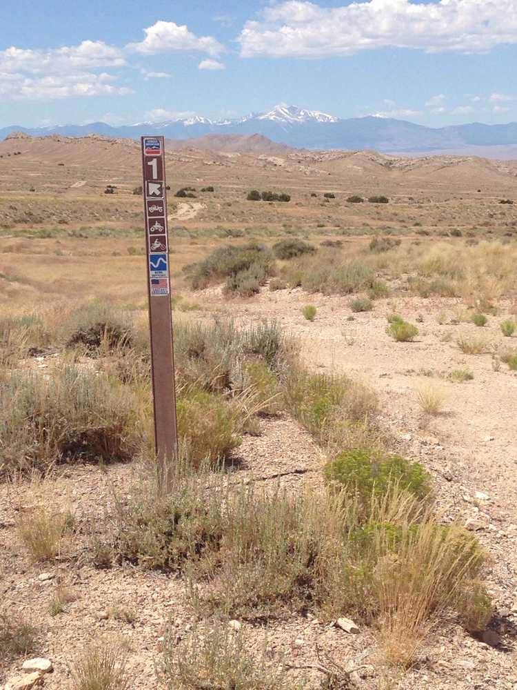
- OHVs: All sizes. No width limits. ATVs, MCs, UTVs, 4x4s on most trails. You may encounter gates. Leave them as you find them..
- Terrain: Easy - Mostly graded county roads.
- Signage: The main routes have adequate signage but some trails aren't very clear where they go. This is a good place to have a GPS..
- KML File for Google Maps
- GPX File for your Garmin GPS or other Apps
- Delta Community Hospital 435-864-5591
- Millard County Sheriff (435) 864-2755 Dial 9-1-1 for emergencies
GAIA
We highly recommend you get GAIA GPS for your mobile device. GAIA GPS will allow you to download this trail complete with the photos you see here so you can be sure where you are at all times. Simply install the GAIA GPS app and save this trail from the button below.
Here is the 360 view at the trailhead. Feel free to tour around a bit inside Google Street Views. We have recorded the trail in 360 and it is now part of Google Street Views so you can take a virtual tour of the trail to see if it is for you. We’ve made it a bit easier to navigate, scroll down and you will see more 360 embedded tours as we encounter intersections, trail markers or interesting places along the trail.
On any image, you can click the ‘X’ in the upper right corner and the view will change to an overview map showing the Google Street View blue lines. You can click anywhere on that blue line and drop down to the 360 ground-level views at that point.
You can move the image 360 degrees, click the arrow to move further down the trail and zoom in and out to take a closer look. Clicking the box in the upper right-hand corner will enlarge to full screen for a better view.

