

Eagle Canyon is a scenic drive in the San Rafael Swell. To explore this area, take I-70 to exit 116 for Moore. There is a rest area just off the highway and a frontage road that will take you to the trailhead. There are no services for about 50 miles around the trailhead so you will want to stock up on supplies and fuel in Green River, Ferron, Hanksville or Salina (depending on which direction you are traveling from). The trail is 50 miles long and we spent 4.5 hours riding at 11 mph. This is an incredibly scenic area to explore, so you will want to plan a full day for this trip.
- Directions From the North
- Directions from the South
- Facilities: Closest services to the area are about 50 miles. Stock up on supplies and fuel in Green River, Ferron, Hanksville or Salina (depending on which direction you are traveling from).
- OHVs: All sizes. No width limits. ATVs, MCs, UTVs, 4x4s on most trails.
- Signage: Most trails have adequate signage.
- KML File for Google Maps
- GPX File for your Garmin GPS or other Apps
We highly recommend you get GAIA GPS for your smartphone or tablet mobile device. GAIA GPS will allow you to download this trail complete with the photos you see here so you can be sure where you are at all times. Simply install the GAIA GPS app and save this trail from here: DOWNLOAD THIS TRAIL
Here is an embedded live link to GAIA GPS to allow you to explore the trail. Each of the blue markers indicates that a photo was taken at that location. To view the track and photos click here: GAIA GPS – Eagle Canyon
Would you like to see the trail in an animated 3D flyover map? If it appears to pause that is likely a place we stopped for a while. It will continue, just wait a few moments. Link to 3D flyover.
Here is the 360 view at the trailhead. Feel free to tour around a bit inside Google Street Views. We have recorded the trail in 360, and it is now part of Google Street Views so you can take a virtual tour of the trail to see if it is for you. While we didn’t have time to ride all of the trail, we think you will find this fairly representative of what you will find. We’ve made it a bit easier to navigate, scroll down and you will see more 360 embedded tours as we encounter intersections, trail markers or interesting places along the trail.
On any image, you can click the ‘X’ in the upper right corner and the view will change to an overview map showing the Google Street View blue lines. You can click anywhere on that blue line and drop down to the 360 ground-level views at that point.
This is the trailhead for Eagle Canyon. There is plenty of space for unloading and a couple places where you can set up an RV.
Follow the BLM sign for Eagle Canyon.
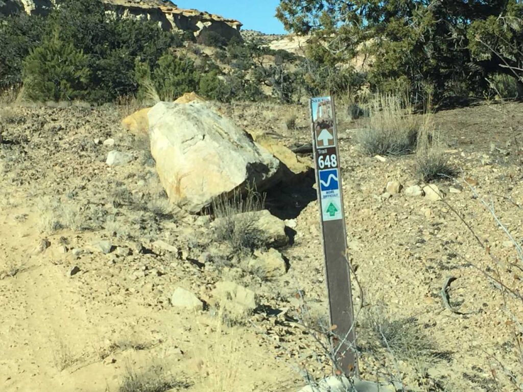
Trail Sign 648 labels this route more difficult.
The desert’s color palette surrounds us.
Turn right following the sign’s directions to Swasey Cabin and Rods Valley.
Passing under I-70 on the Eagle Canyon Trail.
Eagle Canyon Arch. Don’t forget to pack the camera!
Stay left heading southeast. This is the beginning of the loop (Trail 820).
Parking area, kiosk and vault toilet at Swasey’s Cabin.
Turn right heading south. The BLM sign is pointing back toward Swasey’s Cabin.
Stay right heading west.
Turn left to stay on trail 928 heading southwest.
Turn right to head southwest.
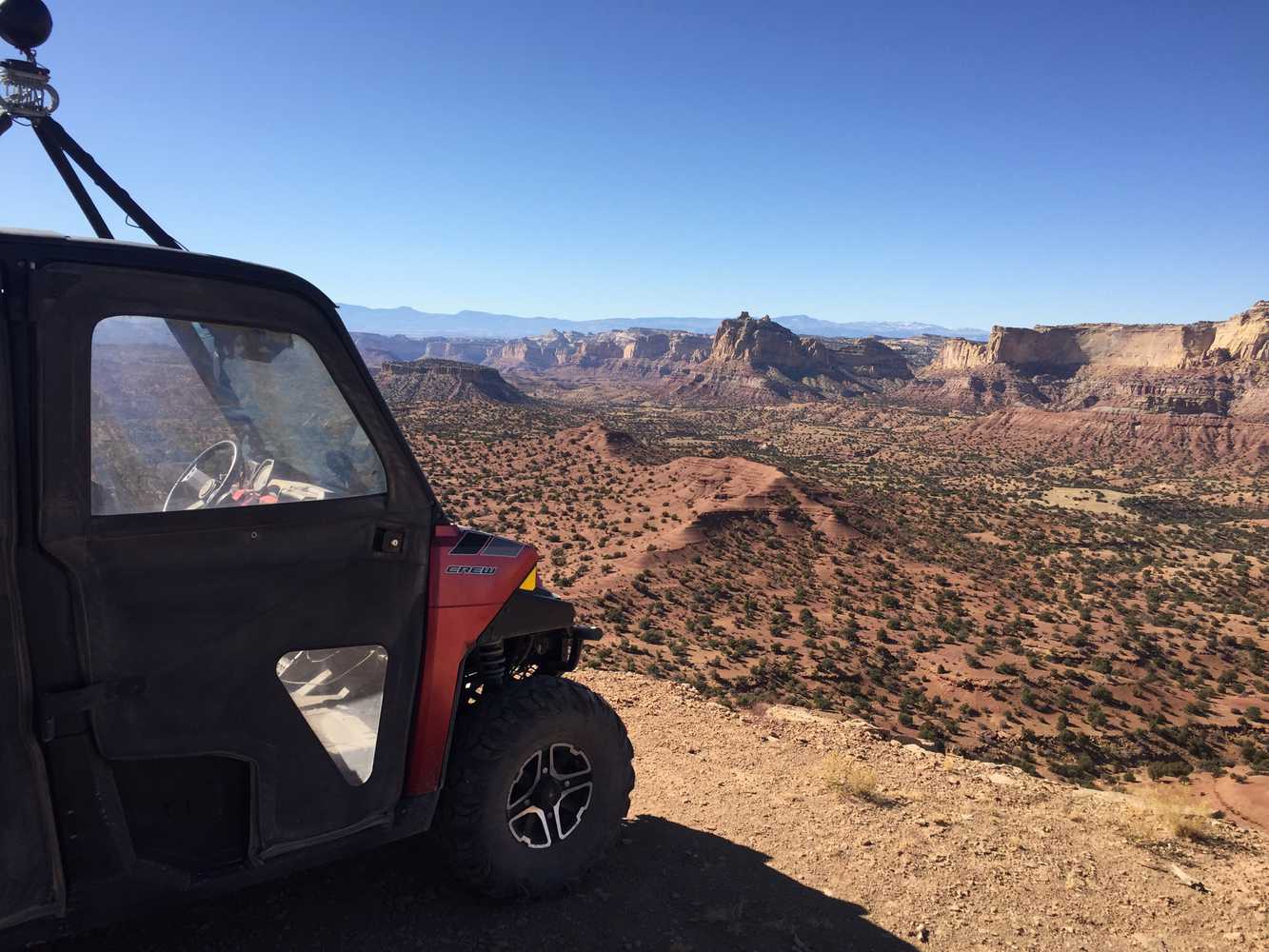
Spectacular views to the west looking across the San Rafael Swell toward Square Top (7,375 feet).
Hard left to head northwest where the trails cross.
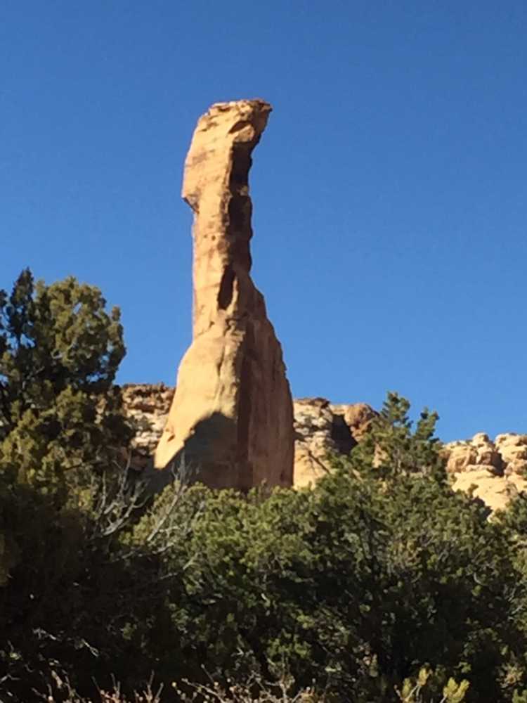
The rock spire for which the canyon gets its name.
You are back to the beginning of the loop stay left heading north to return to the trailhead.
Here is a photo gallery of all of the images we took along the way. Not necessarily in any order or sequence. Many are at trail intersections. You can see the photos and exactly where along the trail where taken: Click here for Photo Locations.


Emergencies
The closest medical help is Green River Medical Center 585 Main Street, Green River, UT 84525. Dial 9-1-1 for emergencies or (435) 564-3434
If a hospital is required, Castleview Hospital is in Price. 300 North Hospital Drive, Price, UT 84501. Open 24 hours · (435) 637-4800
Emery County Sheriff – Green River: Dial 9-1-1 or (435) 381-2404
Utah Highway Patrol – Green River: Dial 9-1-1 or (435) 564-3474
BLM Office in Price: (435) 636-3600
We highly recommend you purchase a Utah Search and Rescue Assistant Card (USARA), learn more: https://secure.utah.gov/rescue/

