

The Stud Horse Draw OHV Loop is a good ride for beginners that lies off the beaten path. The trailhead is 15 miles or so west of Enterprise and offers some unique scenery, riding and a trip back to the Old West. The 50-mile trip took us about 4.5 hours to complete with an average moving speed of 11.5 mph.
Terrain consists of mostly dirt and gravel roads that take off across the flats for some high desert riding. Picnic tables and ponderosa pines make the stop at pine park a good place to have a picnic and take in something different than the junipers and sagebrush.
Enterprise makes a great base-camp offering a small motel, groceries, fuel and a couple eateries. Nearby Enterprise Reservoir and the surrounding area offer great opportunities for camping.
This is a popular ride during the Tristate ATV Jamboree that typically takes place in March. You can find out more about this event and find some great people to ride with by visiting https://www.thetristateatvclub.com/
- Directions From the North
- Directions from the South
- Facilities: Lodging, restaurants, fuel and groceries are all available in Enterprise. There are no services available along the trail.
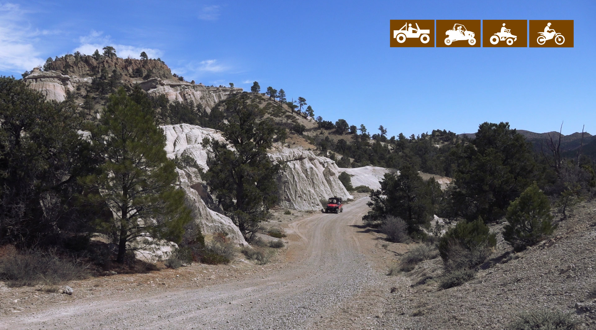
- OHVs: All sizes. No width limits. ATVs, MCs, UTVs, 4x4s on most trails.
- Terrain: Mostly dirt and gravel roads.
- Signage: The area is signed fairly well but some of the signs are weathered. Look at our notes below and download a GPS track (see below).
- KML File for Google Maps
- GPX File for your Garmin GPS or other Apps
- Emergencies: The closest medical help is Enterprise Valley Medical Clinic, 223 S 200 E Street, Enterprise, UT 84725. Dial 9-1-1 for emergencies.
- Washington County Sheriff: Dial 9-1-1 or 620 S 5300 W, Hurricane, UT 84737 (435) 656-6500. We highly recommend you purchase a Utah Search and Rescue Assistant Card (USARA) learn more: https://secure.utah.gov/rescue/
GAIA
We highly recommend you get GAIA GPS for your mobile device. GAIA GPS will allow you to download this trail complete with the photos you see here so you can be sure where you are at all times. Simply install the GAIA GPS app and save this trail from the button below.
Here is the 360 view at the trailhead. Feel free to tour around a bit inside Google Street Views. We have recorded the trail in 360 and it is now part of Google Street Views so you can take a virtual tour of the trail to see if it is for you. We’ve made it a bit easier to navigate, scroll down and you will see more 360 embedded tours as we encounter intersections, trail markers or interesting places along the trail.
On any image, you can click the ‘X’ in the upper right corner and the view will change to an overview map showing the Google Street View blue lines. You can click anywhere on that blue line and drop down to the 360 ground-level views at that point.
You can move the image 360 degrees, click the arrow to move further down the trail and zoom in and out to take a closer look. Clicking the box in the upper right-hand corner will enlarge to full screen for a better view.

