

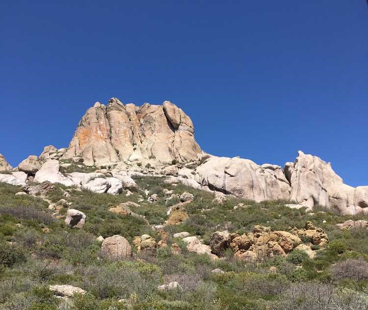
The Pinnacles OHV Trail is a loop that will take you around Enterprise Reservoir, up Park Canyon looking west toward Nevada, and then dropping down into the valley where you will ride past some impressive geologic features “The Pinnacles.”
The trail is approximately 45 miles and we rode it in 3.5 hours without any stops. Our average speed on the trail was about 10.5 mph and we gained 2,100 feet (6,700′ elevation) before dropping back down to 4,600 feet back in Veyo.
This trail can access several other trails in the area to make for a full day of riding or take your time and explore the area. There are numerous camping options in this area or you can find a motel in Enterprise with a greater variety of lodging options out of Cedar City or St. George.
An obvious perk of this particular trail is the ability to quickly escape civilization without being too far away. There are no services along the trail but you will find some pit toilets when you pass Enterprise Reservoir.
- Directions From the North
- Directions from the South
- Facilities: Lodging, restaurants, fuel and groceries are all available out of Enterprise to the north. You can also find fuel and supplies on your way to the trailhead in Veyo. The trail is also close to the St. George and Cedar City area.
- OHVs: All sizes. No width limits. ATVs, MCs, UTVs, 4x4s on most trails.
- Terrain: Mostly dirt and gravel roads.
- Signage: The area is well signed but a GPS is a huge plus.
- KML File for Google Maps
- GPX File for your Garmin GPS or other Apps
- Emergencies: The closest medical help is Enterprise Valley Medical Clinic, 223 S 200 E St, Enterprise, UT 84725. Dial 9-1-1 for emergencies.
- Washington County Sheriff: Dial 9-1-1 or (435) 656-6500. We highly recommend you purchase a Utah Search and Rescue Assistant Card (USARA) learn more: https://secure.utah.gov/rescue/
GAIA
We highly recommend you get GAIA GPS for your mobile device. GAIA GPS will allow you to download this trail complete with the photos you see here so you can be sure where you are at all times. Simply install the GAIA GPS app and save this trail from the button below.
Here is the 360 view at the trailhead. Feel free to tour around a bit inside Google Street Views. We have recorded the trail in 360 and it is now part of Google Street Views so you can take a virtual tour of the trail to see if it is for you. We’ve made it a bit easier to navigate, scroll down and you will see more 360 embedded tours as we encounter intersections, trail markers or interesting places along the trail.
On any image, you can click the ‘X’ in the upper right corner and the view will change to an overview map showing the Google Street View blue lines. You can click anywhere on that blue line and drop down to the 360 ground-level views at that point.
You can move the image 360 degrees, click the arrow to move further down the trail and zoom in and out to take a closer look. Clicking the box in the upper right-hand corner will enlarge to full screen for a better view.

