

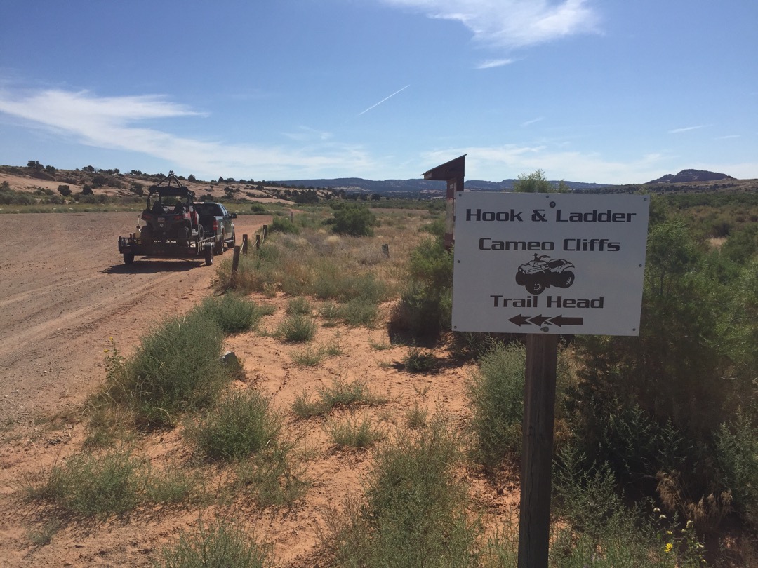
The Hook and Ladder trails are located in South Eastern Utah in San Juan County approximately 30.6 miles south of Moab, and 23.5 miles North of Blanding Utah, with good parking located off Utah Hwy 191. This is within the Cameo Cliffs Special Recreation Management Area (SRMA) and is managed by the BLM. The Trailhead is just a 1.2 mile East of Hwy 191. Look for a turnoff headed East just barely north of Mile Marker 95. Approximately 50 miles of the route are marked within the area. It will take you all day(s) to explore this system and it is well worth the trip. There are no services so stock up on anything you need before leaving Moab (or Monticello if you are coming from the South) This is a great place to get away and enjoy some solitude while exploring a seldom seen part of Utah. The riding is pleasant and scenic, trails vary from easy to intermediate to expert. Consult the Online printable map (below) for which trail sections have which ratings.
- Directions From the North
- Directions from the South
- Facilities: Vault Toilet at Trailhead only
- You may encounter Gates, Leave them as you find them.
- OHVs: All sizes. No width limits. ATV’s, MC’s, UTV’s, 4x4s on most trails.
- Signing: Most Trails have adequate signage
- Maps: Available in Monticello at the San Juan County Tourism office 117 S Main St, Monticello, UT 84535
- Online Printable Map
- KML File for Google Maps
- GPX File for your Garmin GPS or other Apps
We highly recommend you get GAIA GPS for your smartphone or tablet mobile device. GAIA GPS will allow you to download this trail complete with the photos you see here so you can be sure where you are at all times. Simply install the GAIA GPS app and save this trail from here: DOWNLOAD THIS TRAIL
Here is an embedded live link to GAIA GPS to allow you to explore the trail. Each of the blue markers indicates that a photo was taken at that location. It looks like I left the GPS on all the way back to Monticello. Oh well, at least you can see how far it is to town. To view the track and photos click here: GAIA GPS – Hook and Ladder
Would you like to see the Hook and Ladder Trail in an animated 3D flyover map? If it appears to pause that is likely a place I stopped for a while. It will continue, just wait a few moments. 3D Flyover Link.
Here is the 360 view at the trailhead. Feel Free to tour around a bit inside Google Stree Views. We have recorded the trail in 360 and it is now part of Google Street Views so you can take a virtual tour of the trail to see if it is for you. While we didn’t have time to ride all of the trails we think you will find this fairly representative of what you will find. We’ve made it a bit easier to navigate, scroll down and you will see more 360 embedded tours as we encounter intersections, trail markers or interesting places along the trail.
On any image, you can click the ‘X’ in the upper right corner and the view will change to an overview map showing the Google Street View Blue lines. You can click anywhere on that blue line and drop down to the 360 ground-level views at that point.
You can move the image 360 degrees, click the arrow to move further down the trail and zoom in and out to take a closer look. Clicking the box in the upper right-hand corner will enlarge to full screen for a better view.
Trail #3 is to the left. We stayed on Trail #1.
There is a ledge here that you might consider going around to the left.Many parts of Hook and Ladder remind us of trails around Moab. Slick rock and Hoodoos.
The trail hugs the rim of the ledges in spectacular fashion.
We were wondering if this formation has a name.
Some sections are smooth sailing.
That is Trail #6 to the Left.
The trip back to the trailhead along the bottom of the canyon is sandy and smooth.
Here is a photo gallery of all of the Images we took along the way. Not necessarily in any order or sequence. Many are at trail intersections. You can see the photos and exactly where along the trail where taken: Click here for Photo Locations.


Emergencies
The closest medical help is Moab Hospital 450 Williams Way, Moab, UT 84532. Dial 911 for Emergencies or (435) 719-3500
San Juan County Sheriff 911 or (435) 587-2237
Utah Highway Patrol (435) 587-2000
BLM Office in Monticello (435) 587-1500

